The Ha Giang Loop map looks different for every rider, but most people end up exploring the same highlights: legendary mountain passes, ethnic villages, and jaw-dropping landscapes like Ma Pi Leng Pass and the Dong Van Karst Plateau. I’ve ridden these roads myself, and every bend felt like a mix of challenge and reward. This guide, built with insights from Vietnamese Motorbike Tours, will help you plan your adventure using the most reliable Ha Giang travel routes.
Why Ride the Ha Giang Loop?
Ha Giang sits in northern Vietnam, about 320 km from Hanoi—roughly a 6–8 hour motorbike journey. The region borders China to the north and offers a wild mix of limestone peaks, rice terraces, and remote highland villages. Unlike tourist-heavy Sapa, Ha Giang feels raw and untamed. That’s exactly why riders love it.
The weather stays cooler than the lowlands (21–23°C on average). Each season changes the scenery: October–December brings pink buckwheat flowers, spring fills the valleys with white apricot blossoms, and summer turns the rice terraces into bright green stairways. No matter when you go, the ride feels fresh and unforgettable.
- Check out the best time to travel to Vietnam
Surprisingly, Mapping the right route, allowing riders to visit some some of the 19 ethnic groups, each with unique traditions and flavors. Don’t miss local specialties like Mac Khen spice, Doi seeds, star anise, cardamom, and honey-infused mountain dishes. Sharing a meal here feels like stepping into another world.

Top 5 Routes on the Ha Giang Loop Map
When you look at a Ha Giang Loop map, it can feel hard to choose where to ride first. The good news is that there are a few main routes that every rider loves. These routes in Ha Giang take you through winding mountain passes, small ethnic villages, and some of the most amazing viewpoints in Vietnam. Whether you plan a short trip or the full Ha Giang motorbike loop, knowing the right path will save you time and give you the best experience. Below, we’ll share the top four rides you should not miss when following the Ha Giang travel map.
- Check out Ha Giang Loop Motorcycle Tour

1. Hanoi to Ha Giang city: The Route Map (~300km)
Riding from Hanoi to Ha Giang feels like the first big step into Vietnam’s northern mountains. The journey takes around six to seven hours by motorbike, depending on your pace and stops. Leaving Hanoi, the city noise slowly fades, and open roads lead you through small towns and rice fields. The route is long, but it builds the excitement for the Ha Giang Loop. I remember stopping for strong Vietnamese coffee along the way, stretching my legs, and then jumping back on the bike, knowing each kilometer brought me closer to those winding mountain passes. The Hanoi to Ha Giang route map helps you plan fuel stops, food breaks, and the best overnight options if you don’t want to ride it all in one go.
2. Ha Giang – Tam Son: A Scenic Warm-Up (~50km)
This route, on the map, allows you to ride up to nearly 1,000m above sea level, making it a great choice if you’re short on time (1–2 days). You’ll breathe fresh mountain air while weaving past terraced fields that shimmer green during harvest season. When I rode this stretch in November, the buckwheat flowers painted the hills in soft pink and purple—an unforgettable sight.
Highlights include Quan Ba Heaven Gate, Quan Ba Twin Mountain, and the Nam Dam community village. Visit on a Saturday morning to catch the vibrant Quyet Tien market, where locals dress in traditional attire and trade mountain goods. Living in a traditional Mong home here gives you a taste of true highland culture.
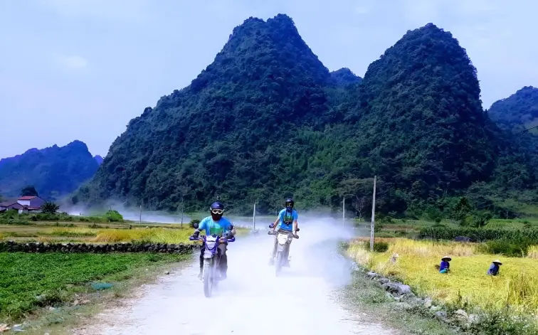
3. Tam Son – Yen Minh: Ride through Endless Pines (~70km)
From Tam Son to Yen Minh, winding roads lead you through sweeping mountain views and diverse ethnic villages. In late autumn, buckwheat flowers drape the hillsides, making the ride both romantic and adventurous.
The star here is the Yen Minh Pine Forest. Riding under tall pines in cool mist feels almost European, yet deeply Vietnamese. Stop by Du Gia village for waterfalls and peaceful homestays—perfect for cooling off after long hours on the bike. Local dishes like Au Tau porridge, Tam Giac Mach cake, and Men Men (steamed corn) keep your energy high.
4. Yen Minh – Dong Van – Lung Cu: The Northern Frontier (~70km)
This section is way too popular with adventure motorbike rider, it challenges you with zigzags, high cliffs, and daring passes, but it rewards every rider who loves a good test. Riding through Dong Van Karst Plateau feels like time travel, with French-era stone houses and ancient Hmong traditions still intact. You’ll sense the raw connection between people and the land.
End this stretch at Lung Cu Flag Tower, Vietnam’s northernmost point. Standing here, looking across into China, fills you with both pride and wonder. The food in Dong Van—like buffalo jerky, five-color sticky rice, and Bac Me Lam rice—tastes even better after a day of conquering mountain passes.
5. Dong Van – Meo Vac – Du Gia: Conquering Ma Pi Leng Pass (~125km)
If you crave adrenaline, this is the crown jewel. Ma Pi Leng Pass, one of Vietnam’s four greatest passes, stretches along cliffs above the jade-green Nho Que River. Riding here is both terrifying and mesmerizing—you’ll grip your handlebars tighter, but you won’t stop smiling.
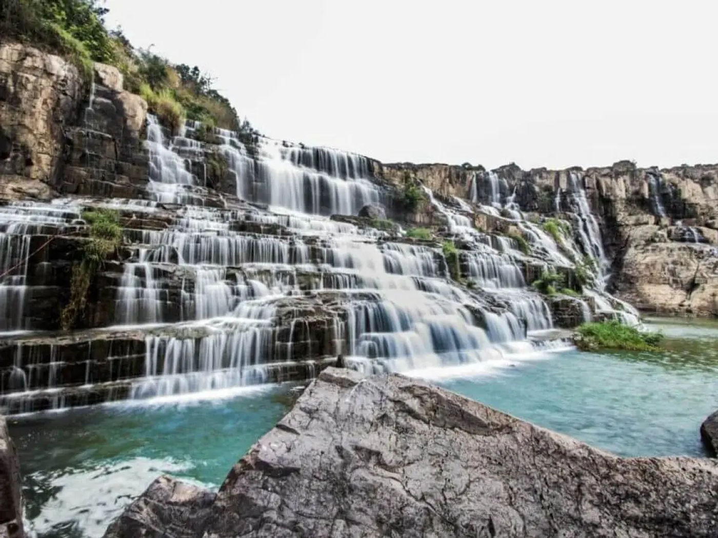
From Meo Vac, the road snakes 80 km to Du Gia village, where peaceful valleys and the Tham Luong waterfall await. Camping or trekking here after days of mountain riding feels like a reward in itself. The friendly villagers often guide you to hidden gems not shown on maps, so don’t hesitate to ask.
Local Tips for Riding the Ha Giang Loop
- Travel in October–December for buckwheat blooms, or spring for blossoms.
- Rent a reliable motorbike from Ha Giang city (semi-automatic is easier for beginners).
- Always carry some cash—ATMs are rare in remote towns.
- Ask locals for shortcuts or scenic detours—they know the land better than any app.
Riding the Ha Giang Map isn’t just about landscapes—it’s about connecting with people, food, and traditions along the way. Each bend in the road tells a new story. If you love adventure, culture, and nature, this loop deserves a spot on your bucket list.
The Bottom Line
The Ha Giang Loop Map 2026 is more than just a route guide—it’s your ticket to one of Vietnam’s most breathtaking adventures. With the right map, smart planning, and a spirit for exploration, every twist and turn becomes a story worth remembering. Whether you ride for the landscapes, the culture, or the challenge, the Ha Giang Loop promises a journey you’ll never forget.
About the Author
Hamid is a travel writer and an ADV motorbike rider based in Hanoi. With years of experience riding the country’s mountain roads, he shares firsthand insights to help travelers discover the best routes, hidden gems, and local cultures across Southeast Asia. When not on the road, he’s busy documenting authentic travel tips to make your journeys smoother and more memorable.