Looking for one-day motorbike loop in Northern Vietnam? This stunning region offers some of the most thrilling riding experiences in Indochina. Towering mountains, lofty passes, and scenic routes make northern Vietnam a dream destination for motorbike riders. For many, this part of the country becomes the highlight of their Vietnam road trip. The landscapes are breathtaking, the roads challenge every level of rider, and the region’s rich history and culture add depth to every journey.
Hello everyone, im Hamid, the owner of Vietnamese Motorbike Tours and here, i’ve gathered all my top northern Vietnam motorbike guides into one ultimate collection of 14 Northern Routes. You can ride each loop as a standalone adventure or connect them into a continuous North Vietnam motorbike tours that covers the best of area.
One-Day Loops in Northern Vietnam: Introduction and Essential Tips
Northern Vietnam offers some of the most exciting one-day motorbike loops in Southeast Asia. With winding mountain passes, rice-terraced valleys, and authentic hill-tribe villages, this region is a paradise for riders who crave both adventure and culture. Whether you’re exploring misty mountain roads or cruising through scenic river valleys, each route promises breathtaking views and a true sense of discovery.
This part of the country particularly stands out for its diversity of landscapes and well-connected routes, making it ideal for short, one-day motorbike trips. Depending on where is your starting point, whether Hanoi, Sapa, Ha Giang, mu Cang Chai, or even toward center and cities like Nghe An, Thanh Hoa and more. each area offers with the high mountain passes, remote ethnic villages, and peaceful countryside offer endless opportunities for memorable rides without the need for long-distance travel. Riders can easily design flexible itineraries, linking shorter loops into longer multi-day journeys that showcase the very best of the north.
- Check out Motorbike tour in Vietnam
About the one day loops around Northern Vietnam
I’ve organized the 14 routes geographically, starting south of Hanoi and moving from west to east across the northern provinces. The color-coded map shows shaded areas representing the regions covered by each route and includes direct links to their detailed guides.
Although these routes cover thousands of kilometers, they still represent only a fraction of northern Vietnam’s countless incredible roads and offbeat tracks. The best time to ride in Northern Vietnam is from March to May and September to November, when the weather is clear, cool, and perfect for motorbiking.
- Mường Lống Loop (north-central)
- Limestone Loop (north-central)
- Trans-Northern Belt Road (pan-northern)
- Harvest Route (northwest)
- Extreme Northwest Loop (northwest)
- Sin Ho Loop (northwest)
- Y Ty Loop (northwest)
- Borders & Back-Roads Loop (northwest)
- Tuyen Quang Magic ‘8’ Loop (central north)
- Ha Giang Loop (extreme north)
- The High-Roads Routes (northeast)
- The Northeast Loops (northeast)
- Binh Lieu Loop (northeast)
- Tam Dao (A 2 Horus ride from Hanoi)
1. Muong Long Loop
- Starting Point: Vinh
- Key Stops: Kim Liên, Thanh Chương, Con Cuông, Mường Xén, Mường Lống, Qùy Châu, Qùy Hợp
- Total Distance: 630 km
- Estimated Duration: 4-7 days
- Loop Highlights: As you travel through Nghệ An, you’ll be treated to stunning landscapes, including: Verdant Agricultural Valleys, Limestone Karsts, Brooding Mountains, Glistening Rivers, Vast Rice Fields, Beautiful Waterfalls, Tea Hills
- Road Conditions: The route features mostly good paved roads, but be prepared for occasional rough patches. There are also opportunities for scenic detours along the way.
- Best Time to Ride: The ideal months to embark on this journey are from April to July, when the weather is most favorable.
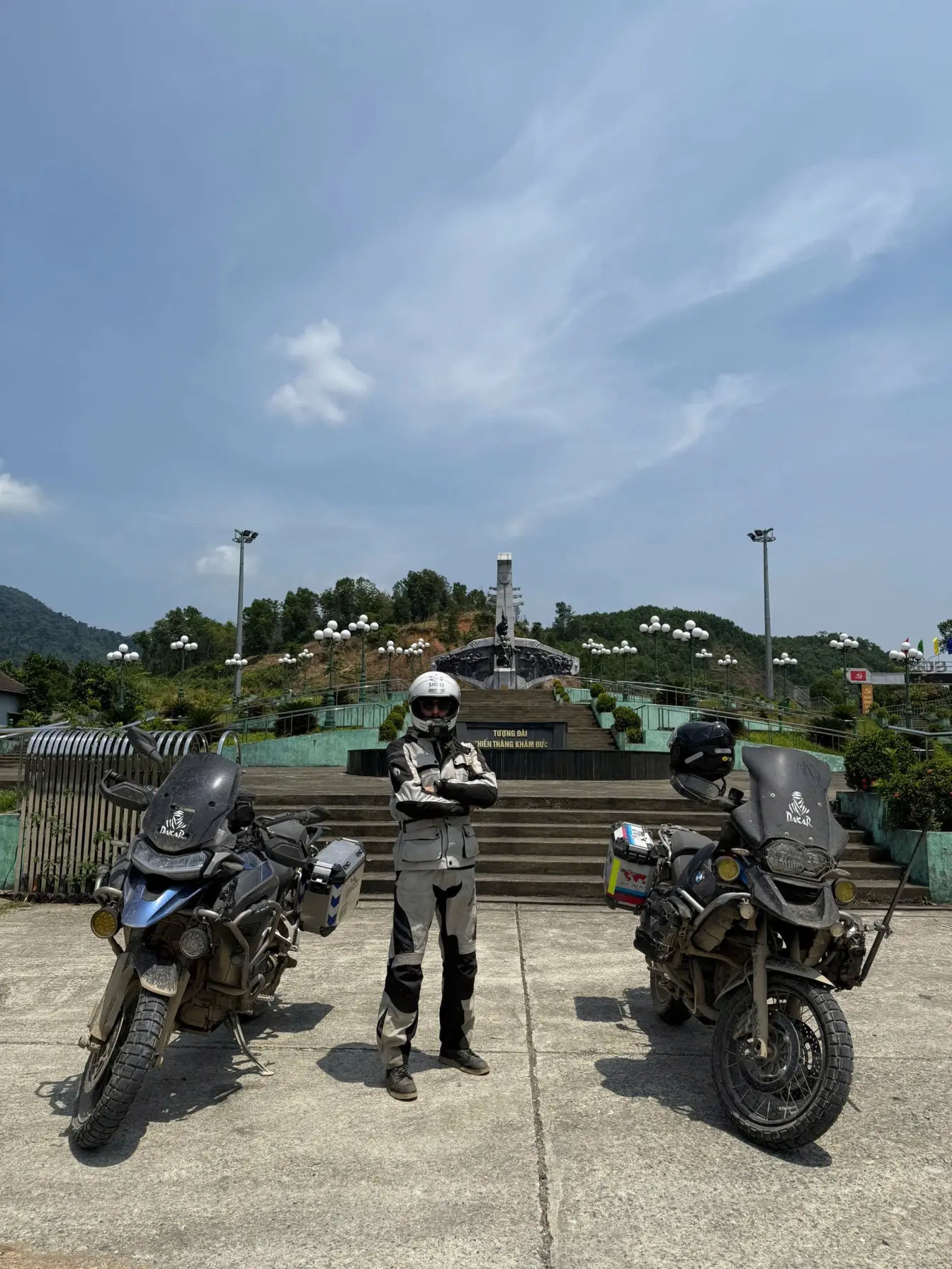
Riding the Looparound Vinh City, Nghệ An, the territory is located in north-central Vietnam, Nghệ An is the surprisingly country’s largest province and remains one of the least explored by tourists and riders. While many riders tend to overlook this region, Nghệ An offers some of the most remarkable motorbiking experiences in Vietnam, making it a must-visit destination for road enthusiasts.
One of the standout routes in this province is the Mường Lống Loop, which promises stunning scenery and thrilling adventure. This least ridden motorbike journey stretches from the eastern coast to the mountainous border with Laos in the west, eventually forming a picturesque mini-loop near Mường Lống. This remote village, nestled in the far northwest of Nghệ An, features some of the most breathtaking roads and landscapes in all of Vietnam.
ROUTE MAP: The Mường Lống Loop
2. Hanoi – Lao border Loop
- Starting Point: Hanoi
- Key Destinations: Mai Châu, Pù Luông, Lao Border
- Total Distance: 700-800 km
- Estimated Duration: 1-3 days
- Scenic Highlights: This journey takes you through breathtaking landscapes, featuring limestone Karsts, Bamboo Forests, Charming Villages, Vast Rice Fields, local Home-stays
- Road Conditions: The route is primarily made up of good, paved roads and lanes, though you might encounter some rough sections. Expect fairly light traffic, making it a pleasant ride.
- Best Time to Ride: The ideal time to embark on this adventure is between March and October, when the weather is most favorable for exploring.
Discover the Hanoi-Loa border Loop, this is a Scenic Motorbike Adventure from Hanoi, suitable for so many expats looking to do visa runs from Hanoi to the Na Meo border check-point.
Located just a few hours southwest of Hanoi, the Loop offers an incredible motorbiking experience featuring some of Vietnam’s most stunning landscapes. This route primarily winds through Thanh Hóa, a province renowned for its dramatic limestone pinnacles, serene rivers, and lush rice paddies.
As you ride along the quiet roads, you’ll encounter steep valleys adorned with bamboo forests and navigate mountain passes that lead to remote crossings into Laos.
While many travelers flock to the more touristy Ninh Bình & Tam Coc, Thanh Hóa remains a hidden gem that is just beginning to gain recognition. One of the highlights of this region is the hidden Pù Luông, a Nature Reserve, known for its pristine beauty and tranquil environment.
ROUTE MAP: The Hanoi – Lao Border Loop
3. Loop from Halong to Điện Biên via QL279
- Starting Point: Hạ Long
- Distance: 937 km
- Duration: 3-6 days
- Provinces Covered: Bắc Giang, Lạng Sơn, Bắc Kạn, Tuyên Quang, Hà Giang, Lào Cai, Lai Châu, Sơn La, Điện Biên
- Loop’s highlights: This journey showcases a variety of beautiful landscapes, including majestic mountains, Limestone karsts, Lush jungles, Serene rivers, Scenic valleys, Traditional villages, Terraced rice fields, Tranquil lakes & Stunning waterfalls
- Road Conditions: The route primarily features good, paved roads, though you may encounter some narrow sections and ongoing roadworks. Traffic is generally light, making for a pleasant ride.
- Best Time to Ride: For the best experience, plan your trip between March and October when the weather is ideal for exploring.
Stretching 937 kilometers across Vietnam’s widest and most mountainous region, National Route 279 (QL279) is the third longest road in Vietnam. Also known as Đường Vành Đai Phía Bắc (Trans-Northern Belt Road), this loop travels through 10 northern provinces, showcasing some of the country’s most breathtaking landscapes and challenging terrain.
Following an arc along the northern border with China, QL279 loop holds deep historical significance. The route’s name commemorates the Sino-Vietnamese border war of February 1979 with 2 symbolizing February, 79 representing the year 1979, and QL meaning quốc lộ or national route.
Take this scenic yet mountainous road all the way from Halong city to the city of Dien Bien Phu.
ROUTE MAP: The Trans-Northern Belt Loop
4. Mù Cang Chải to Tú Lệ Loop
- Distance & Duration: Approximately 50 km (1 day loop)
- Province: Yên Bái, Northern Vietnam
- Highlights: Stunning rice terraces, lush valleys, rivers, mountain scenery, and charming local villages with traditional homestays.
- Road Conditions: Mostly paved main roads and well-maintained backroads with light traffic, ideal for motorbike trips.
- Best Time to Ride: May to October, especially during the rice growing and harvest season for the most vibrant landscapes.
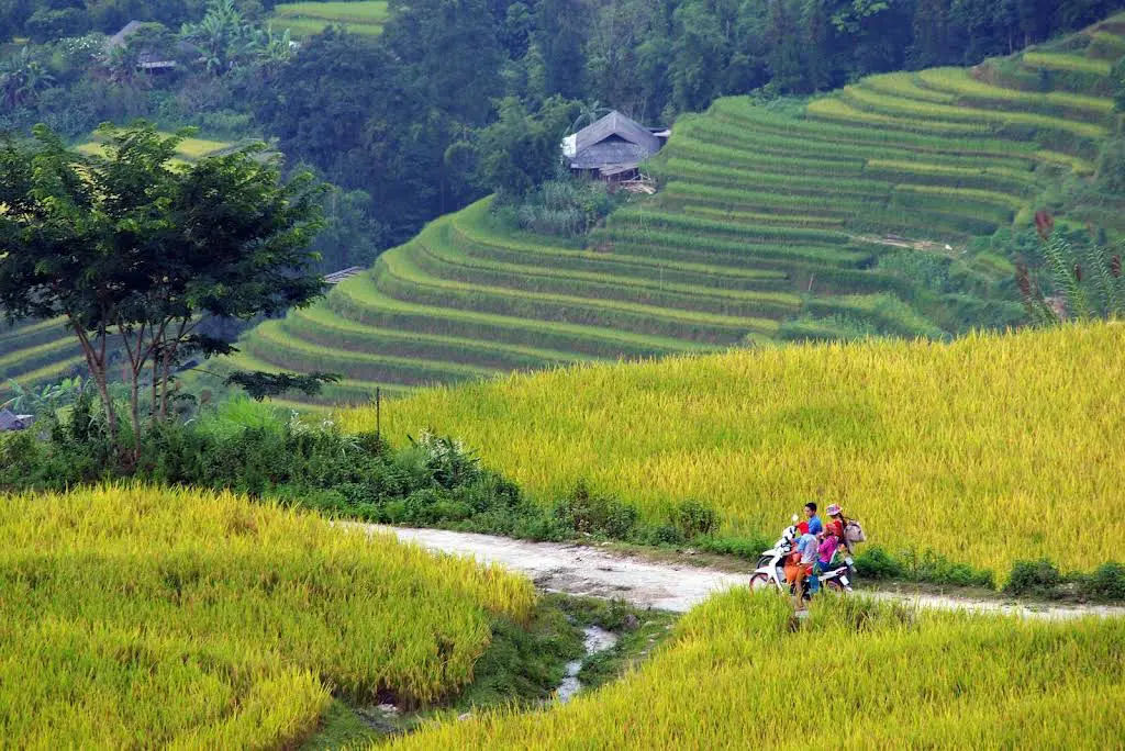
I call this a harvest route, or loop to Vietnam’s most eye-catching rice terraces. Every year from September to October, the terraced rice fields of Mù Cang Chải in Yên Bái Province transform into a breathtaking sea of gold.
As the autumn sun shines over the steep valleys, hundreds of layered rice paddies glow in vibrant shades of yellow and green. These curving terraces, carefully shaped by generations of local farmers, blend seamlessly with the natural landscape—creating one of Vietnam’s most stunning rural scenes.
Often described as the “Theatre of Rice,” this spectacular display is best experienced along the Harvest Route, a scenic stretch of Highway QL32 connecting Tú Lệ and Mù Cang Chải. The journey passes through the dramatic Khau Phạ Pass, offering panoramic views of mountains, valleys, and endless rice terraces that make it a must-ride for motorbike travelers and photographers alike.
ROUTE MAP: Mù Cang Chải Loop
5. Extreme Northwest Loop
- Route: Lào Cai, Lai Châu, Mường Lay, Mường Tè, Mường Nhé, Điện Biên Phủ
- Distance & Duration: Approximately 300–800 km, taking 2–4 days depending on your pace and stops.
- Provinces Covered: Lào Cai, Lai Châu, and Điện Biên
- Highlights: Experience the wild beauty of Vietnam’s remote borderlands—from towering mountains and winding rivers to lush rice terraces and ethnic minority villages.
- Road Conditions: Roads are mostly paved but remote, with sections prone to landslides during the rainy season. Expect very light traffic, making it perfect for adventurous riders.
- Best Time to Ride: April to October, when the weather is warm and the landscapes are at their most vibrant.
Vietnam’s Extreme Northwest loop is the wild Frontier Between Lào Cai and Điện Biên Phủ, this routes are stretching across the Black River basin, Vietnam’s far northwest region is a vast and rugged land of mountains and mist. This is arguably the most remote corner of Vietnam, and certainly one of the least explored by independent riders.
Bordering both China and Laos, the route from Lào Cai to Điện Biên Phủ winds through sensitive border zones and untouched landscapes rarely seen by tourists.
Because of its proximity to the Golden Triangle, travelers may occasionally encounter local checkpoints or travel restrictions, adding to the sense of adventure and isolation.
Newly built mountain roads now carve deeper into the highlands than ever before, connecting small ethnic villages and revealing breathtaking views of peaks that soar nearly 10,000 feet. This circuitous journey offers a true off-the-beaten-path experience, ideal for riders seeking raw nature, cultural encounters, and some of the wildest mountain scenery in Vietnam.
ROUTE MAP: the northwest Loop
6. Sin Ho Loop
- Loop: Sapa, Lai Châu, Sìn Hồ, Phong Thổ
- Distance & Duration: Around 320 km, best explored over 2–3 days
- Province Covered: Lai Châu Province
- Highlights: Discover towering mountains, deep valleys, winding rivers, and rice terraces that stretch across the hillsides. This route offers a peaceful ride with light traffic and plenty of chances to experience authentic highland life.
- Road Conditions: Expect well-paved mountain highways and quiet backroads, with a few rough sections in more remote areas—perfect for motorbike riders who enjoy a bit of adventure.
- Best Time to Ride: April to October, when the weather is clear and the landscapes are at their greenest.
The Sìn Hồ Loop is the northern Vietnam’s Hidden Alpine route perched high on the slopes of the Hoàng Liên Sơn Mountain Range, once called the Tonkinese Alps during the French colonial era.
Sìn Hồ is a peaceful market town surrounded by towering peaks and misty valleys. The ride to Sìn Hồ follows spectacular mountain roads, weaving through remote ethnic villages such as Pa Tần, Phong Thổ, and Lai Châu, where life moves to the rhythm of the mountains.
Unlike Sapa, Vietnam’s well-known mountain retreat that now draws large crowds, Sìn Hồ remains quiet and authentic, offering a glimpse into the region’s unspoiled charm. The Sìn Hồ Loop connects the two highland towns through breathtaking mountain passes, rewarding riders with panoramic views and some of the most dramatic alpine scenery in Southeast Asia.
ROUTE MAP: Sin Ho Loop
7. Y Ty Loop from Sapa
- Route: Sapa, Y Tý, Chinese Border, Lào Cai
- Distance & Duration: Around 195 km, taking 1–2 days depending on stops and riding pace.
- Province Covered: Lào Cai Province
- Highlights: This route showcases the remote beauty of Vietnam’s northern borderlands, with rice terraces, mountain ridges, winding rivers, and ethnic minority villages scattered along the way. The area around Y Tý is especially breathtaking, known for its cloud-covered valleys and traditional stilt houses.
- Road Conditions: Expect mostly paved backroads with a few rough patches, but very little traffic, making it ideal for adventurous riders seeking solitude and scenery.
- Best Time to Ride: April to October, when the skies are clear, the rice terraces turn vibrant green, and the weather is perfect for mountain travel.

The Y Tý Loop has not yet been discovered much by the tourists, even many locals never heard about it, this is a hidden Gem North of Sapa along the rugged mountains stretch all the way to the Chinese border, creating one of the most dramatic landscapes in perfect for One-Day Loops in Northern Vietnam for Motorbiking.
Winding roads cut through steep, terraced valleys and rise high above rushing mountain rivers, leading to remote ethnic minority villages where traditional life still thrives.
Ride to Y Tý, which starts and ends in Sapa via the hilltop village of Y Tý, offers an unforgettable motorbike ride through pristine highlands and breathtaking scenery.
Road Conditions: The loop is mostly paved with winding mountain passes, though some sections are narrow, rough, and weather-affected, especially during the rainy season, adding a touch of adventure for confident riders.
ROUTE MAP: Y Ty – Lao Cao Loop
8. Northern Back-Roads Loop along the borders
- The loop: Sapa, Lào Cai, Mường Khương, Si Ma Cai, Bắc Hà, Xín Mần, Hoàng Su Phì, Hà Giang
- Distance & Duration: Approximately 235–480 km, best completed over 2–5 days depending on your pace and sightseeing stops.
- Provinces Covered: Lào Cai and Hà Giang
- Highlights: This route takes you through some of Vietnam’s most stunning mountain scenery—from deep gorges and winding passes to borderland villages and towering rice terraces. Along the way, you’ll encounter remote ethnic minority communities, peaceful valleys, and some of the most authentic rural landscapes in the north.
- Road Conditions: Expect mostly paved backroads in good condition, with occasional rough patches and a risk of landslides during the rainy months. Traffic is typically light, making it ideal for motorbike riders seeking a scenic and adventurous route.
- Best Time to Ride: April to October, when the weather is dry, the roads are passable, and the rice terraces glow in shades of green and gold.
This is the Sapa to Hà Giang Route covering the Vietnam’s Ultimate Northern Mountain Adventure along the borders with China. Connecting two of Vietnam’s most spectacular mountain provinces, Lào Cai and Hà Giang, this motorbike loop traces the Chinese border, winding over rugged mountain ranges and along breathtaking river valleys.
The journey from Sapa to Hà Giang is not just a road trip, it’s an expedition through the remote northern highlands, where every turn reveals another dramatic panorama.
The route follows narrow mountain roads carved into steep cliffs, passing through ethnic minority villages, border towns, and vibrant local markets surrounded by lush farmland. It’s an experience defined by hairpin bends, misty passes, and ever-changing landscapes that capture the raw beauty of Vietnam’s frontier.
- Check out alternatives to Ha Giang Loop
Because of the challenging terrain and unpredictable weather, riders should take this journey slowly, allowing extra time for possible landslides or road closures, all part of the adventure that makes the Sapa–Hà Giang motorbike route one of the most unforgettable rides in Southeast Asia.
ROUTE MAP: Northern borders loop
9. The loop around Tuyen Quang
- Route: Tuyên Quang, Vĩnh Lộc, Na Hang, Lâm Bình
- Distance & Duration: Around 260 km, best enjoyed over 2 days with time for scenic stops.
- Province Covered: Tuyên Quang Province
- Highlights: This tranquil route winds through limestone karst mountains, sparkling rivers, and mirror-like lakes, surrounded by lush rice fields, palm forests, and colorful fruit and vegetable farms. It’s a perfect escape for travelers seeking Vietnam’s quieter countryside and authentic local life.
- Road Conditions: Expect mostly paved provincial roads in decent shape, with a few rough patches and exciting off-road detour opportunities for adventure riders.
- Best Time to Ride: April to October, when the weather is warm, the fields are green, and the landscapes are at their most vibrant.
The Tuyên Quang Loop can be easily ride and discovered from Hanoi, it is less than 100 km north of Hanoi, the mountainous and culturally diverse province of Tuyên Quang remains one of Northern Vietnam’s best-kept secrets. Despite its proximity to the capital, this region is rarely explored by travelers, offering an authentic slice of rural Vietnam.
The roads here wind along quiet rivers, curve around limestone karsts, pass through pomelo orchards, and cross gentle mountain passes, creating a peaceful yet adventurous motorbike route ideal for riders seeking solitude and scenery.
Surrounded by more popular destinations like Hà Giang and Ba Bể Lake, the Tuyên Quang Magic ‘8’ Loop can easily be enjoyed as a standalone trip from Hanoi or as part of a longer Northern Vietnam motorbike adventure.
Road Conditions: The loop features smooth provincial roads with occasional gravel sections, making it accessible for both experienced and casual riders.
ROUTE MAP: Tuyen Quang loop
10. The ever famous Ha Giang Loop
- Route: Hà Giang, Tam Sơn, Yên Minh, Du Gìa, Đồng Văn, Mèo Vạc, Bảo Lạc
- Distance & Duration: Approximately 385 km, best explored over 3–7 days, depending on your pace and how often you stop for viewpoints or local stays.
- Province Covered: Hà Giang Province
- Highlights: This legendary route showcases the limestone karsts, towering gorges, and remote borderlands that define Northern Vietnam’s wild beauty. Riders pass through ethnic minority villages, winding river valleys, and high mountain passes, with countless opportunities for photography and cultural encounters.
- Road Conditions: Expect steep, paved mountain roads with some rough patches and light traffic. The terrain is challenging but incredibly rewarding for experienced riders seeking adventure.
- Best Time to Ride: April to October, when the weather is warm, visibility is clear, and the rice terraces and valleys are at their most vibrant.
Hà Giang, located at the northernmost point of Vietnam, is a province defined by its dramatic limestone mountains, deep valleys, and winding border roads that hug the frontier with China.
This loop can not be visited on a one day loop ride from Hanoi, this remote region offers a landscape unlike anywhere else in the country, a breathtaking mix of conical peaks, crater-like valleys, and mist-covered passes that feel almost otherworldly.
Once known as the final frontier for adventurous travelers, Hà Giang has become a must-visit destination for those seeking raw natural beauty and authentic cultural experiences. While it was once difficult to access, improved roads and local homestays have opened the area to more visitors, making exploration easier without losing its wild charm. Check out Ha giang loop motorbike tours
ROUTE MAP: The loop around Ha Giang
11. The Ha Giang – Ba Be – Cao Bang loop
- Route: Hà Giang, Ba Bể Lake, Cao Bằng
- Distance & Duration: Approximately 310–370 km, taking 1–3 days depending on your route and pace.
- Provinces Covered: Hà Giang, Bắc Kạn, and Cao Bằng
- Highlights: This route connects three of Northern Vietnam’s most stunning landscapes—the karst mountains of Hà Giang, the emerald waters of Ba Bể Lake, and the lush valleys of Cao Bằng. Along the way, you’ll encounter terraced rice fields, dense jungle, remote borderlands, and ethnic minority villages where traditional life continues untouched by mass tourism.
- Road Conditions: Expect paved mountain highways and quiet backroads, with occasional rough or off-road sections for more adventurous riders. Be mindful of a risk of landslides during the rainy months, though traffic is generally light and the scenery is consistently rewarding.
- Best Time to Ride: April to October, when the weather is warm, the views are clear, and the landscapes burst with color.
This loop is linking Hà Giang, Ba Bể Lake, and Cao Bằng, the Vietnam’s Northern Mountain Corridor. The roads connecting Hà Giang, Bắc Kạn, and Cao Bằng pass through some of the most dramatic and geologically diverse regions in Vietnam. This northern corridor showcases a landscape shaped by towering limestone karsts, deep river valleys, and sharp mountain ridges, where small villages cling to the slopes and traditional life continues at a slow pace.
A network of mountain roads and backroutes weaves through this rugged terrain, creating multiple ways to travel between Hà Giang, Ba Bể Lake, and Cao Bằng. Each route offers spectacular scenery but also demands patience and skill—expect narrow passes, unpredictable weather, and the occasional landslide that can change the day’s plans.
- Check out Comparison: Ha Giang vs Cao Bang
ROUTE MAP: Ba Be – Cao Bang – ha Giang Loop routes
12. The loop covering northeast
- Route: Cao Bằng, Pác Bó Cave, Bản Giốc Falls, Lạng Sơn, Mẫu Sơn Mountain, Bắc Sơn, Bắc Kạn, Ba Bể Lake
- Distance & Duration: Approximately 165–455 km, taking 1–6 days depending on your chosen route and number of stops.
- Provinces Covered: Cao Bằng, Lạng Sơn, and Bắc Kạn
- Highlights: This diverse route connects some of Northern Vietnam’s most stunning natural landmarks, from the majestic Bản Giốc Waterfall and the historic Pác Bó Cave to the misty peaks of Mẫu Sơn Mountain and the tranquil waters of Ba Bể Lake.
- Road Conditions: Expect mostly paved highways and quiet backroads, with some rough or off-road sections for those seeking adventure. Traffic is light, and the journey offers plenty of opportunities for stops, viewpoints, and photography.
- Best Time to Ride: April to October, when the weather is warm, the roads are dry, and the landscapes are at their most vibrant.
Exploring Vietnam’s Northeast loop, an interesting routes along the Cao Bằng to Ba Bể Lake.
In my view, Cao Bằng, Lạng Sơn, and Bắc Kạn offer some of the best motorcycling experiences in Northern Vietnam. This region is a dream for road trippers filled with dramatic landscapes, winding mountain passes, and tranquil countryside that few travelers ever see.
Starting in Cao Bằng, the road leads you through a series of unforgettable landmarks. Begin your ride at Pác Bó Cave, a site of deep historical significance, before continuing to the spectacular Bản Giốc Waterfall, one of Vietnam’s most photogenic natural wonders located right on the Chinese border. From there, follow the scenic route toward Lạng Sơn, where limestone karsts rise dramatically above green valleys and traditional craft villages dot the landscape.
Next, head up to Mẫu Sơn Mountain, famous for its misty peaks and panoramic views stretching across the borderlands. The journey then winds through Bắc Sơn Valley, a serene area of rice paddies surrounded by towering cliffs, and continues deeper into Bắc Kạn Province, where the roads are quiet, the air is cool, and the scenery shifts between forested hills and small farms.
What makes this route so special is the balance of beautiful scenery, cultural authenticity, and adventure.
The roads are mostly paved and in good condition, with minimal traffic and countless opportunities for detours through mountain backroads and remote villages. Add to that the friendly locals, hearty northern cuisine, and fresh mountain air, and it’s easy to see why this loop remains a favorite among experienced riders.
ROUTE MAP: The northeastern loop
13. Binh Lieu Loop
- Route: Bình Liêu, China Border Road, Dinosaur Spine, Hoành Mô Border Gate, Khe Vằn Waterfall, Cao Sơn
- Distance & Duration: Approximately 115 km, perfect for a 1–2 day motorbike trip
Province: Quảng Ninh - Scenery Highlights: Extraordinary mountain views, deep valleys, forests, jungles, waterfalls, and scenic borderlands near China
- Road Conditions: Mostly good paved roads with some narrow back-roads; very light traffic, suitable for both beginners and experienced riders
- Best Time to Ride: March to October, when the weather is dry, visibility is clear, and the landscape is lush and green
Taking the loop ride toward Bình Liêu, the Hidden Mountain routes around the Northeast Vietnam, the region is nestled in the far northeast of Vietnam, Bình Liêu District is a small yet stunningly mountainous area in Quảng Ninh Province, known for its winding border roads, spectacular highland scenery, and authentic local culture. Surrounded by the Chinese border on three sides, this remote destination features barren peaks rising above lush valleys, cascading waterfalls, and quiet villages connected by steep, adventurous roads.
The region is home to several ethnic minority communities, who make up nearly 96% of the population, offering travelers a rare glimpse into traditional highland life. The Bình Liêu Loop has often been compared to a “mini Hà Giang,” making it a promising alternative for motorbike road trips without the crowds.
However, note that foreign travelers currently need a local permit to stay overnight in Bình Liêu, and a few areas remain restricted due to their proximity to the border. For those who can access it, though, Bình Liêu delivers an unforgettable blend of mountain landscapes, border adventures, and cultural discovery.
ROUTE MAP: Binh Lieu loop
14. Tam Dao Loop form Hanoi
- Route: Hanoi, Vĩnh Yên, Tam Đảo National Park, Tam Đảo Town
- Distance & Duration: Around 85 km one way, ideal for a 1-day or weekend motorbike trip from Hanoi
- Province: Vĩnh Phúc (with access from Hanoi)
- Scenery Highlights: Winding mountain roads, misty pine forests, waterfalls, tea hills, and panoramic valley views overlooking northern Vietnam
- Road Conditions: Mostly good paved mountain roads with some sharp bends and steep ascents; moderate traffic, especially on weekends
- Best Time to Ride: April to October, when the weather is clear and green, or November to February for cooler misty mountain views
Perched high in the mountains of Vĩnh Phúc Province, just 85 km from Hanoi, Tam Đảo is one of northern Vietnam’s scenic and accessible mountain suitable for a day ride from Hanoi.
The ride to Tam Đảo takes about 2 hours, winding through lush countryside, tea plantations, and mist-covered slopes that climb sharply into the clouds. The road conditions are generally excellent, with smooth asphalt and well-marked curves, though the final ascent includes steep, winding turns that demand careful handling.
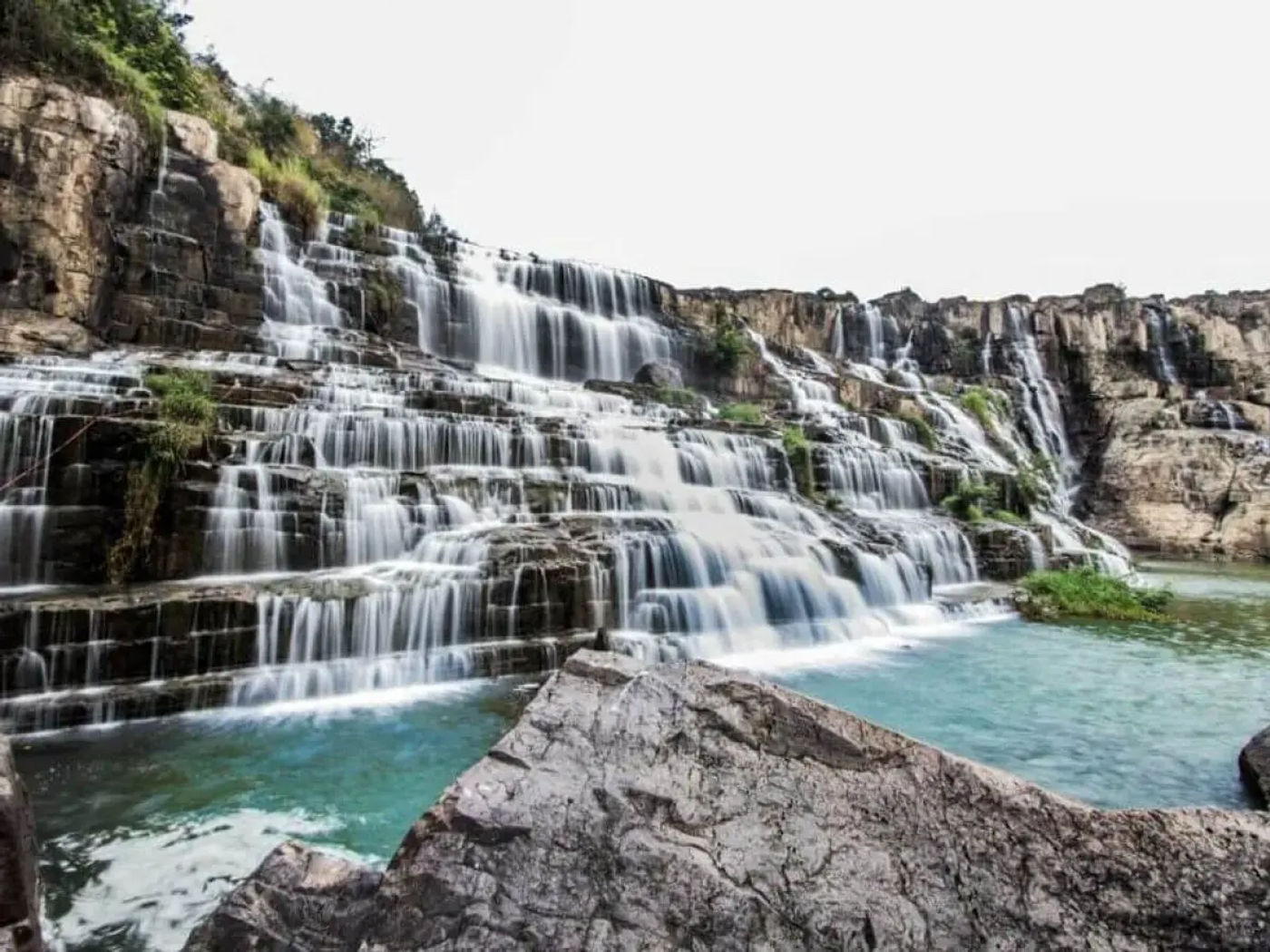
Motorbikers love this route for its combination of cool mountain air, challenging bends, and panoramic views that make the journey as rewarding as the destination. Once you reach the mountaintop town, you can explore Tam Đảo National Park, the Silver Waterfall, Sky Gate viewpoint, ancient French villas, and enjoy local dishes like grilled hill chicken and bamboo-tube rice while overlooking a sea of clouds.
ROUTE MAP: Tam Dao loop from Hanoi
Essential Tips for One-Day Motorbiking Trips
Choosing the Right Motorbike
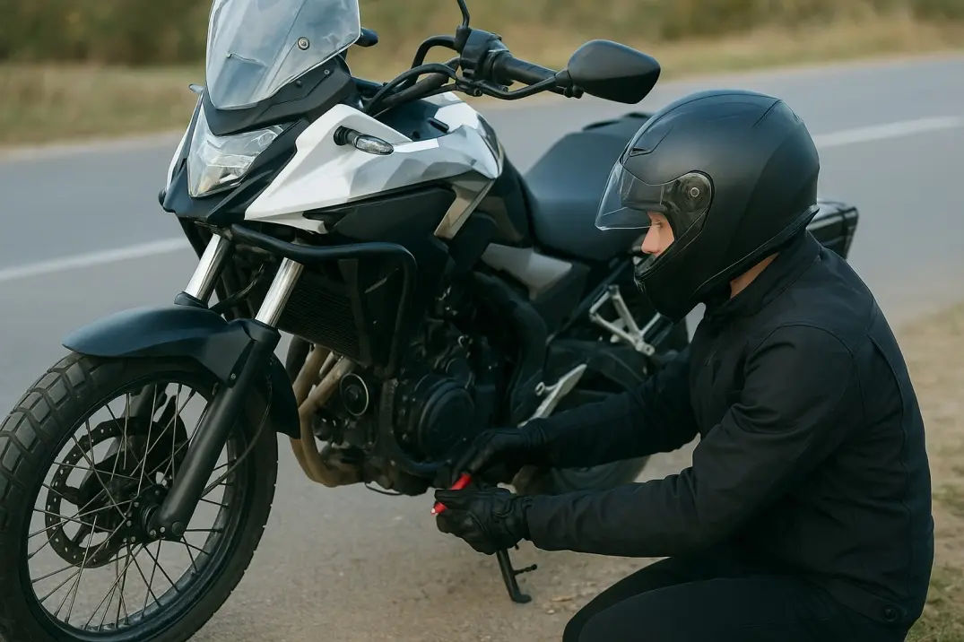
When picking a bike for a one-day ride in Vietnam, choose something reliable and suited to mixed terrain. Many riders on forums say opting for a 125-150 cc bike with good suspension makes a huge difference on rough back-roads. Also check the rental bike thoroughly: tyres, brakes, lights and overall condition. Even on a short trip you’ll thank yourself for a stable bike.
Safety Gear and Precautions
A common thread in travel-forum advice is: always wear a quality helmet and protective clothing—even for a day trip. Bring gloves, closed shoes and a light jacket that can handle unexpected rain or wind. Pack a small repair kit, basic first-aid items and some water; many travelers say the “unexpected delay” is what turns a short ride into a long one.
Also, be realistic about your license and insurance. Many foreign riders in Vietnam are technically uninsured if they ride without the correct permit. Check out how to get an international driving permit for Vietnam
Best Times of Day to Ride
We always recommend to start early, ideally before sunrise or soon after, to beat both traffic and heat. I personally recommend leaving very early in the morning will allow you to travel quickly out of the city and make the whole day much more enjoyable.
Morning hours often bring sharper light (great for photography) and lighter traffic through mountain passes. Avoid the middle of the day in remote regions, when rain or fog tends to build up and visibility drops.
Photography and Scenic Stops
The best things in Vietnam aren’t planned, so the photography opportunities are the same.
On a one-day motorbike loop, you’ll find plenty of scenic spots to stop, relax, and capture stunning photos. Aim to reach mountain ridges during golden hour, just after sunrise or before sunset, when light casts dramatic shadows across limestone peaks and valleys.
Take short detours to hidden waterfalls or riverside paths for peaceful, photo-worthy moments away from traffic. As you pass through ethnic minority villages, you’ll encounter authentic scenes of daily life, children playing, terraced rice fields, and traditional stilt houses perfect for storytelling shots.
In higher elevations, misty passes often reveal layers of clouds, creating surreal “sea of clouds” images if you’re patient. Finally, don’t overlook secluded forks and backroads; many riders say the best photos often come from spontaneous stops where few travelers venture.
One-Day Motorbiking Loops in Northern Vietnam: Key Takeaways
Exploring Northern Vietnam by motorbike in a single day offers a perfect balance of adventure, scenery, and accessibility. Short loops around destinations like Tam Đảo, Bình Liêu, or Ba Bể Lake give riders a taste of Vietnam’s mountain beauty without the need for multi-day travel.
Roads are generally well-paved, routes are clearly marked, and you’ll find plenty of scenic viewpoints, local food stops, and welcoming villages along the way.
And, if you’re an experienced rider or a first-timer looking for a day escape from Hanoi, these suggested loops has been carefully ridden, planned and they deliver rewarding landscapes and cultural encounters at a manageable pace.
Frequently Asked Questions (FAQ)
Which one-day motorbiking loop in Northern Vietnam is the most scenic?
The Bình Liêu Loop or the Pu Luong,both offers the most dramatic mountain scenery, with winding border roads and sweeping views across China’s highlands.
How long does it take to complete each one-day loop?
Most loops take 4–6 hours of riding, I actually spends on the starting point, stops and road conditions, making them easy to complete in a single day.
What type of motorbike is recommended for these short trips?
A 150cc (HondaXR150L) or a bigger ADV motorbike such as CB500X, is ideal for comfort, control, and handling on mountain curves.
Are there places to eat and refuel along these loops?
Yes, all routes have small roadside eateries and petrol stations in villages or towns every 20–30 km. Checkout Fuel types in Vietnam
Which loop is most suitable for beginners or less experienced riders?
The Tam Đảo Loop and Mai Châu Loop are best for beginners thanks to their smooth roads, moderate climbs, and short distances.
About the Author
Hamid is an adventure biker and travel writer passionate about exploring Vietnam’s rugged northern loops. He’s ridden across remote regions, documenting scenic routes and local life. Learn more about the Hà Giang region one of his favorite riding destinations.