The Ho Chi Minh Road is a 1,880 km paved highway that runs along Vietnam’s western spine from Hanoi in the north to Ho Chi Minh City in the south. It passes through the Trường Sơn mountain range, the Central Highlands, and the border regions adjacent to Laos and Cambodia. Traffic is low compared to Highway 1 on the coast, and the road climbs through terrain that the coastal route entirely bypasses.
This guide covers the road’s history and route, how to read a map of it, which sections to prioritise, what bike to ride, when to go, and a practical 8-day itinerary from Hoi An to Hanoi.
Ho Chi Minh Road vs Ho Chi Minh Trail: what’s the difference
The two names refer to different things and are regularly confused.
The Ho Chi Minh Trail was a wartime supply network used between 1959 and 1975. It was not a single road. It was a system of tracks, paths, and routes running from North Vietnam through Laos and Cambodia into South Vietnam, used to move troops, weapons, and supplies during the war. Much of it ran through territory that is now Laos, not Vietnam. It was not open to the public and large sections no longer exist as usable roads.
The Ho Chi Minh Road (also called the Ho Chi Minh Highway or Trường Sơn Highway) is a modern paved road built by the Vietnamese government after reunification. Construction began in 1975. The road opened to public traffic in the early 2000s. It runs entirely within Vietnam’s borders, following a roughly parallel path to parts of the wartime trail through the western highlands. It is sealed for most of its length and is the road you ride today.
When riders say they are “riding the Ho Chi Minh Trail,” they mean the Ho Chi Minh Road. The historical trail is a different thing and most of it is inaccessible by standard motorcycle.
Ho Chi Minh Road history
The wartime trail that gave the road its name was established in 1959 under General Võ Bẩm on orders from Hanoi. It ran from the area around Vinh and Dong Hoi on the central coast, crossed the Trường Sơn Mountains into Laos, and re-entered Vietnam near Kon Tum and Gia Lai in the Central Highlands. At its peak during the war, the trail handled tens of thousands of tonnes of supplies per month, supported by an estimated 100,000 workers who maintained and operated it.
The United States military conducted extensive aerial bombing of the trail system, including covert operations inside Laos, throughout the 1960s and early 1970s. Despite the bombing campaign, the network remained operational until the end of the war in 1975.
After reunification, the Vietnamese government began constructing a permanent paved highway along the western corridor to connect remote highland provinces and former war zones. The modern Ho Chi Minh Road was officially inaugurated in 2000 and progressively extended. It is now fully paved from the outskirts of Ho Chi Minh City to the outskirts of Hanoi, with some sections still missing short connectors at the extreme north and south.
Key wartime sites that now sit directly on or near the road include Khe Sanh Combat Base, the DMZ zone near Đông Hà, the Vĩnh Mốc Tunnels, and the Trường Sơn National Cemetery near Đông Hới.

Ho Chi Minh Road map and route overview
The road divides into three geographic sections. Understanding which section you are riding helps with fuel planning, accommodation expectations, and road surface preparation.
| Section | Route | Key notes |
|---|---|---|
| Southern | Ho Chi Minh City → Gia Nghĩa → Buôn Ma Thuột → Kon Tum (~650 km) | Red basalt soil, coffee and rubber plantations, wider roads, more traffic near cities. Fuel stops every 40–60 km. |
| Central | Kon Tum → Khe Sanh → Phong Nha → Đông Hới (~680 km) | The most remote and scenic section. Western Ho Chi Minh Road between Khe Sanh and Phong Nha has one reliable fuel stop across ~240 km. Narrow concrete slab surface in places. |
| Northern | Đông Hới → Tân Kỳ → Mai Châu → Hanoi (~550 km) | Wider, better surfaced, more services. Highland valleys and ethnic minority villages. Road merges with Highway 6 near Mai Châu. |
The embedded map below shows the full route with key stopping points.
Quick facts: Ho Chi Minh Road at a glance
| Route | Hanoi to Ho Chi Minh City (or reverse) along Vietnam’s western highlands and Trường Sơn mountain range. |
|---|---|
| Total distance | Approximately 1,880 km full route. |
| Recommended duration | 12 to 14 days for the full route. 5 to 7 days for the central section (Hoi An or Khe Sanh to Hanoi). |
| Road surface | Mostly sealed asphalt. Concrete slab sections on the western central stretch. Occasional potholes and gravel patches after wet season. |
| Traffic density | Low to very low. Long stretches with no vehicles at all, especially between Khe Sanh and Phong Nha. |
| Best time to ride | March to May for the full route. October to November for the central and northern sections. |
| Best single section | Khe Sanh to Phong Nha (western Ho Chi Minh Road, ~240 km). The most remote and least-trafficked stretch of the route. |
Why was the Ho Chi Minh Trail important
The trail was the primary logistics network for North Vietnam during the war. Without it, the movement of troops and supplies from north to south would have required crossing the heavily monitored DMZ at the 17th parallel, which was heavily fortified and patrolled. The trail bypassed that barrier entirely by routing through Laos and Cambodia.
At its operational peak in the early 1970s, the network included an estimated 20,000 km of tracks and roads, fuel pipelines running parallel to the main routes, and anti-aircraft positions protecting key junctions. The US military dropped more than 2 million tonnes of bombs on the trail system and surrounding areas between 1964 and 1973, more than were dropped on Germany and Japan combined during the Second World War. The trail remained functional throughout.
After the war, the corridor the trail created through Vietnam’s western highlands became the basis for the modern highway. Towns that grew up as trail support points, including Khe Sanh, A Lưới, and Kon Tum, are now the stopping points on the motorbike route.
The Ho Chi Minh Road today: what riding it is actually like
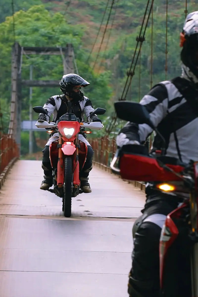
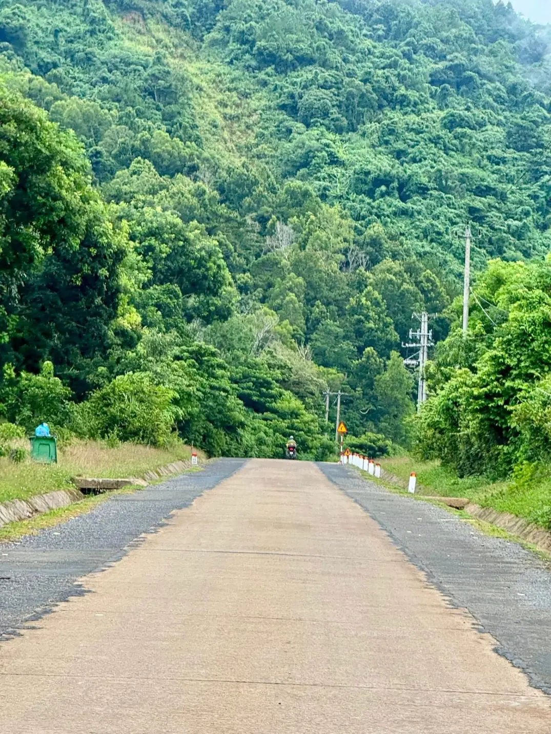
The road is fully paved and carries far less traffic than Highway 1. On the western central section between Khe Sanh and Phong Nha, it is common to ride for 30 to 60 minutes without passing another vehicle. The surface is tarmac on most stretches, with concrete slabs on sections through the western highlands. The concrete slab surface is distinctive: individual slabs with small gaps between them create a rhythmic vibration at speed and wear tyres faster than standard asphalt. Check tyre pressure and tread before any long slab section.
Services are sparse. Between Khe Sanh and the Phong Nha area, riders consistently report one reliable petrol station across approximately 240 km. Accommodation exists in the larger towns (Khe Sanh, A Lưới, Long Sơn) but guesthouses in smaller villages may have only two or three rooms. Travelling with a full tank and booked accommodation is not optional on this stretch.
Mobile signal on Viettel is generally reliable in towns and on the main road, but drops in valleys and between ridge crossings. Download offline maps (Maps.me or Google Maps offline) before you leave each town.
- Check out motorbike tips for riding in Vietnam
Which direction to ride: Hanoi to Saigon or Saigon to Hanoi
Both directions work. The road is symmetrical in terms of difficulty and scenery. The practical differences come down to where you start your trip and what you want at the end of it.
Riding south to north (Saigon to Hanoi) means the most remote central section, Khe Sanh to Phong Nha, comes after you have already ridden 1,000+ km and have better road judgement. The final days approach Hanoi through the green valleys of Mai Châu and Pu Luong, which is a gentler end to the trip.
Riding north to south (Hanoi to Saigon) puts the remote central section early in the trip when your bike is freshly serviced and you are not yet fatigued. You reach Ho Chi Minh City at the end, which has better flight connections if you are returning a rental bike.
Most riders who join only the central portion start in Hoi An or Danang (which sits between the two ends of the western section) and ride north to Hanoi. This is the most popular partial route and takes 8 to 10 days.
Best time to ride the Ho Chi Minh Road
The road passes through multiple climate zones, so no single month is ideal for every section simultaneously.
March to May is the most reliable window for the full route. The central and southern sections are dry, temperatures in the highlands range from 22 to 30°C at midday, and the roads are in good condition after the dry months. This is the period with the fewest weather disruptions.
September to November works well for the northern and central sections. Rain has largely cleared from the highlands by October, temperatures drop to 18 to 25°C, and the rice harvests in valleys like Mai Châu add visual interest. Avoid this window on the southern section, which sees heavy rain through October.
June to August brings the wet season to central Vietnam. The western section between Khe Sanh and Phong Nha can receive 200+ mm of rain per month in July and August. Roads stay passable but passes become slippery and visibility drops significantly in fog. Not recommended for this stretch unless you are an experienced wet-weather rider.
December to February is dry in the south and central sections but brings cool mist and occasional drizzle to the northern highlands. Temperatures at altitude drop to 10 to 15°C overnight. Riding gear with a warm mid-layer is necessary from Phong Nha northward in these months.

Best sections to ride on the Ho Chi Minh Road
If you have limited time, the western central section between Khe Sanh and Phong Nha is the stretch most riders describe as the highlight of the entire route. It covers approximately 240 km of jungle corridor, mountain passes, river valleys, and near-total road isolation. It requires preparation (full tank, booked accommodation, offline maps) but delivers scenery and solitude that no other part of the road matches.
Other sections worth prioritising:
Khe Sanh area and the DMZ corridor
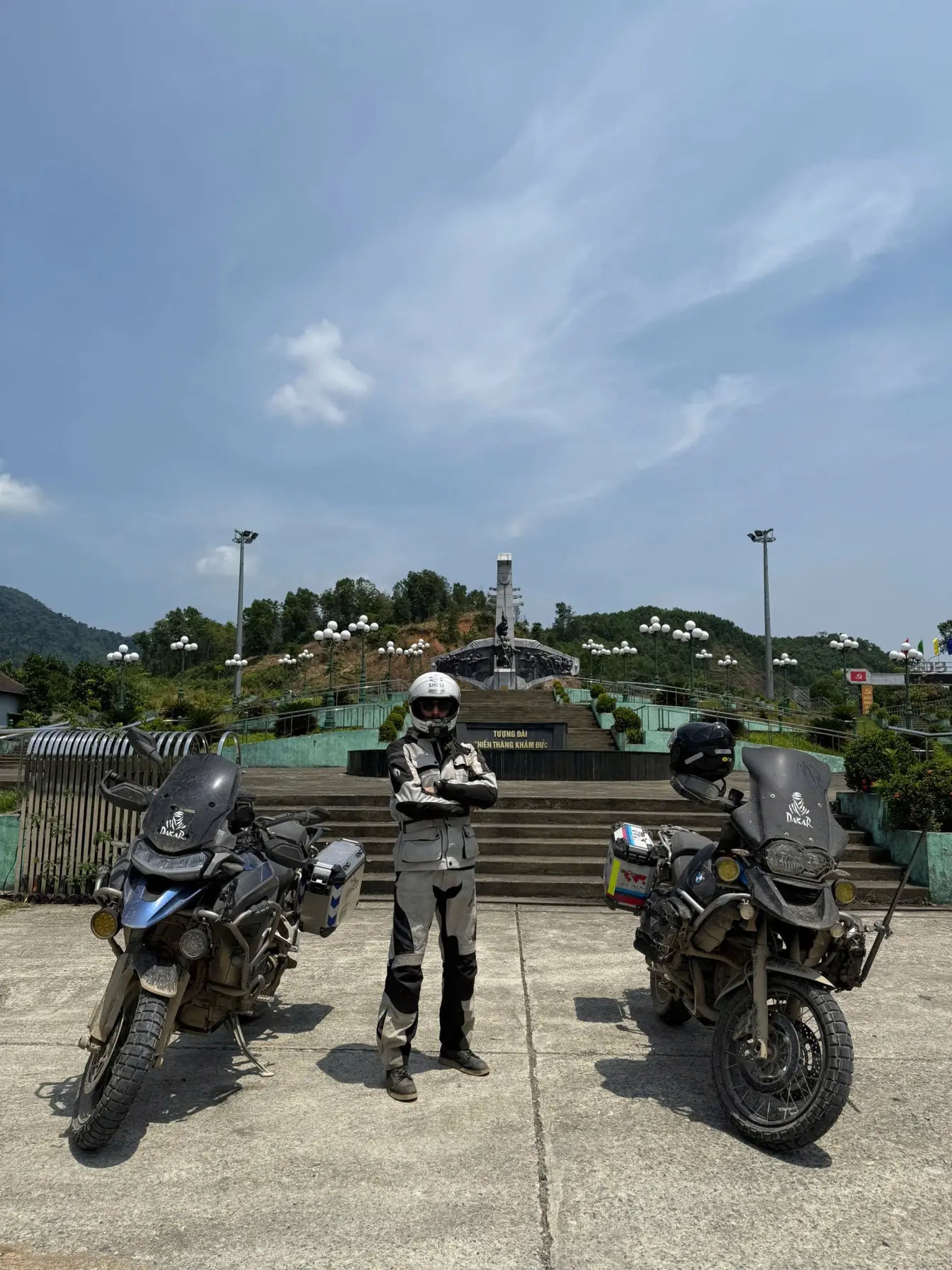
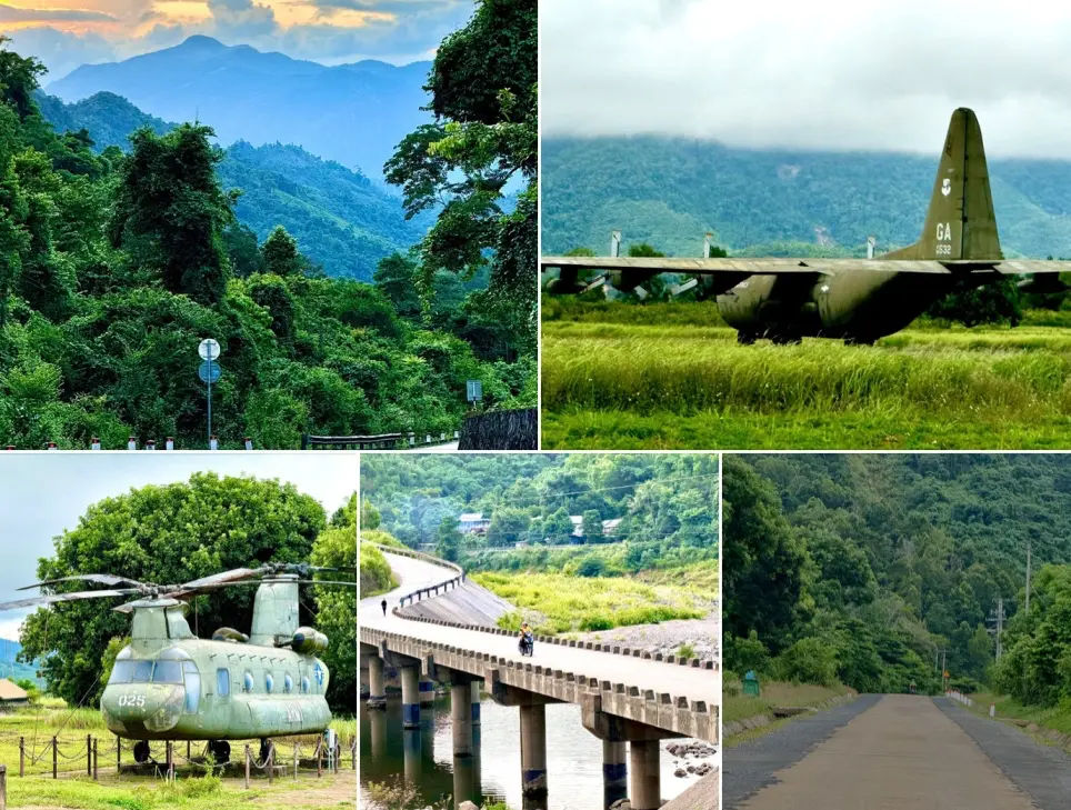
The stretch around Khe Sanh sits at 500 metres above sea level in a valley ringed by forested hills. The Tà Cơn Airport Relic Museum (Khe Sanh Combat Base) preserves aircraft, bunkers, and exhibits from the 77-day siege in 1968. The surrounding hills, including Hill 861 and Hill 881, are accessible by dirt track. The Trường Sơn National Cemetery, 80 km northeast near Đông Hới, holds the graves of more than 10,000 soldiers and is one of the most significant war memorial sites in Vietnam.
The DMZ and Vĩnh Mốc Tunnels are a 60 km detour east from the main road near Đông Hà. The tunnel system, dug between 1965 and 1966, housed an entire village of around 300 people underground for six years to shelter from bombing. The tunnels run 17 to 23 metres deep and are open to visitors daily.
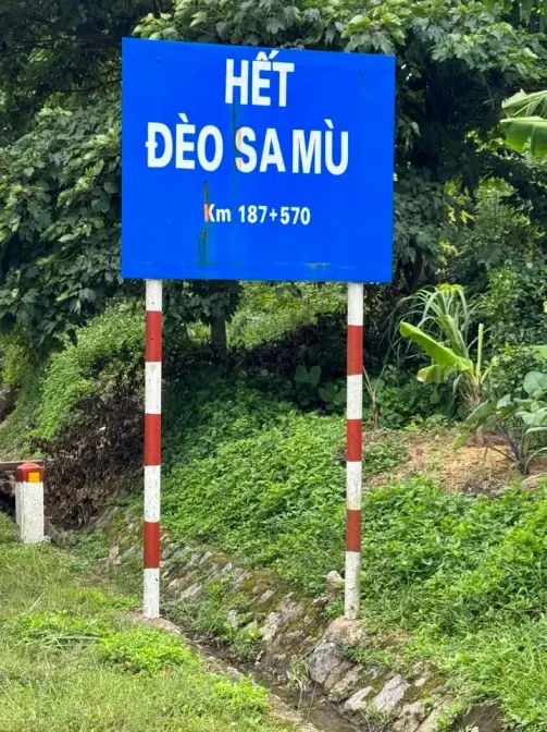
Sa Mù Pass near A Lưới
The Sa Mù Pass on the western section reaches approximately 1,000 metres and crosses the main ridge between the coastal plain and the Laos border corridor. The descent on the western side drops through dense jungle with no roadside development for 30 km. Morning mist fills the valley below the pass until around 9 am. This is one of the most consistently photogenic sections of the road.
Central Highlands: Buôn Ma Thuột and Kon Tum
Buôn Ma Thuột is Vietnam’s largest coffee-producing city and sits at 500 metres. The surrounding plateau grows Robusta coffee on red basalt soil. Kon Tum, 200 km north, has a French colonial wooden cathedral built in 1913 and is the closest large town to the start of the remote central section heading north. Both cities have reliable guesthouses, bike mechanics, and fuel.
Mai Châu valley (northern section)
Mai Châu is a White Thai valley 150 km southwest of Hanoi on the northern section of the road. The valley floor sits at 400 metres, surrounded by limestone hills, and the villages here offer homestay accommodation in stilt houses. It is a common final overnight stop before Hanoi for riders coming north. The 60 km road from Mai Châu to Hòa Bình follows a river gorge and is one of the most enjoyable sealed road sections in northern Vietnam.
Choosing the right motorbike for the Ho Chi Minh Road
The road is paved throughout, but the concrete slab sections, mountain passes, and long fuel gaps mean bike choice matters more than it does on urban Vietnam routes.
The minimum practical bike is a 150cc manual with decent suspension travel. Small automatics (110cc scooters) can complete the route but struggle on sustained climbs and the concrete slab vibration accelerates mechanical wear. If you are renting, avoid low-quality Chinese-brand bikes and older “Win 110” models; they break down on long, remote stretches where roadside help may be an hour away.
Bikes that work well on this road:
| Bike | Best for | Notes |
|---|---|---|
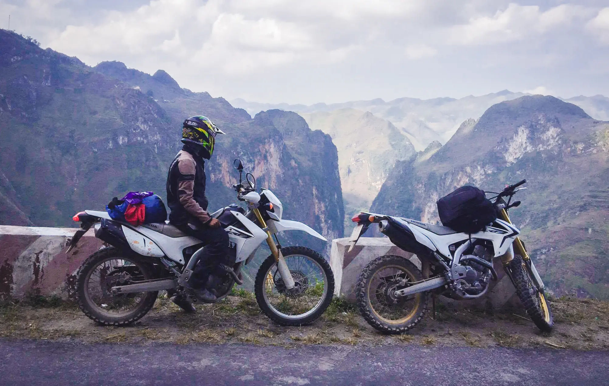
| Honda XR150L / XR190L | Most riders | Most commonly rented on this route. Good suspension, reliable, easy to repair. Fuel range 250–300 km per tank. |
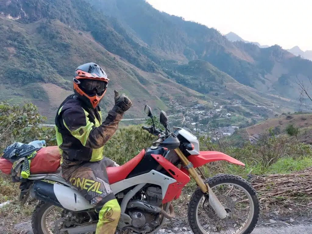
| Honda CRF250 / CRF300 | Off-road detours | Better for dirt tracks to hill sites near Khe Sanh. Smaller fuel tank requires more frequent fill-ups. |
| Honda CB500X | Comfort on long days | Handles the concrete slab sections well. Less manoeuvrable on narrow mountain roads. |
| Royal Enfield Himalayan | Full route comfort | Good balance of comfort and off-road capability. Finding spare parts outside Hanoi and HCMC can be difficult. |
| BMW GS / Triumph Tiger | Experienced riders | Smooth over long distances. High daily range means fewer fuel stops on remote sections. High cost. |
Before the Khe Sanh to Phong Nha section specifically, check: tyre tread (minimum 3mm remaining), chain tension, oil level, and brake pads. Confirm your rental includes roadside support coverage and a phone number that actually answers.
- Check out big bike tours around Vietnam
8-day Ho Chi Minh Road itinerary: Hoi An to Hanoi
This is the most popular partial route on the road. It covers the entire central section and the northern stretch to Hanoi, starting from the coast at Hoi An. Total distance is approximately 1,100 km. We ride Honda XR150L and Honda CB500X motorcycles on our guided version of this route. Bikes are checked before departure and a spare tube, basic tools, and tyre repair kit go in the luggage on every ride.
Day 1: Hoi An, Danang and Son Tra Peninsula
Distance: 40 km, coastal and peninsula roads
Start in Hoi An and ride north to Danang, then out to the Son Tra Peninsula. The peninsula road loops through a nature reserve where the red-shanked douc langur lives. With around 1,500 animals in the reserve, sightings are possible if you ride slowly and watch the canopy, particularly in the early morning on what locals call Monkey Road. The Lady Buddha statue at the peninsula’s southern tip and the viewpoint above it give 360-degree views over Danang Bay and the sea to the east. This is a short day by design: check the bike thoroughly before Day 2.
Day 2: Hải Vân Pass and Hue
Distance: 75 km via the Hải Vân Pass
The Hải Vân Pass rises to 496 metres between Danang and Huế. The road is sealed and the corners are well-surfaced, but fog is common before 10 am and reduces visibility significantly. The pass takes its name from the Vietnamese for “Ocean of Clouds.” A fortified gate at the top, built during the Nguyễn dynasty, is now a rest stop. The descent north drops into a different climate zone: Huế sits in a rain shadow that makes it one of Vietnam’s wettest cities by annual rainfall.
Huế is the former imperial capital and has the most concentrated cluster of historical sites in central Vietnam: the Citadel and Imperial City (entry 200,000 VND), Thien Mu Pagoda (free, 4 km from centre), and the emperor’s tombs spread across 10 km of riverside. Allow half a day. Before leaving Huế, fill the tank and withdraw cash. ATM coverage thins out significantly between here and Khe Sanh.
Day 3: Hue to Khe Sanh
Distance: 175 km via QL49 and QL14
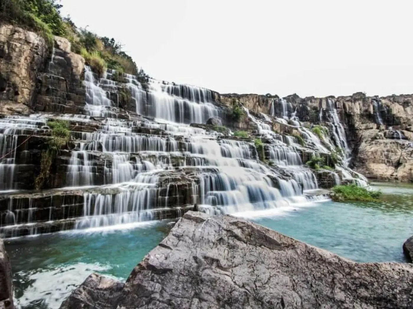
Ride west from Huế on QL49 into the A Lưới valley, crossing the Sa Mù Pass at around 1,000 metres before descending into the highland corridor. The road surface is sealed throughout but narrows on the Sa Mù descent. Stop at Thác A Nôr waterfall, 15 km south of A Lưới, where a short paved trail leads to a pool suitable for swimming in dry season.
Khe Sanh sits at the end of this day, 175 km from Huế. The Tà Cơn Airport Relic Museum (Khe Sanh Combat Base) is open until 5 pm and takes 60 to 90 minutes. Aircraft, artillery, and ground-level bunker structures are preserved on site. If you arrive before 3:30 pm, the museum is worth doing the same day. Fuel up in Khe Sanh before the next day’s ride.
Day 4: Exploring Khe Sanh and the surrounding hills
Distance: 50 to 80 km, loop from Khe Sanh base
Use Khe Sanh as a base for a day of shorter rides. Hill 861 and Hill 881, the sites of two major engagements during the 1968 siege, are accessible by dirt track north of town. The tracks require a 150cc or larger manual bike. The hills themselves are now forested and the summit views extend over the valley and into Laos on a clear day.
Alternatively, the Hamburger Hill area (Đồi A Bia) is 50 km southeast near A Lưới. The hill saw repeated fighting in May 1969 and is now reforested. A small memorial sits near the base.
Return to Khe Sanh for the night. This is your last town with reliable guesthouses and a mechanic before Phong Nha, 240 km away. Check your bike in the evening.
Day 5: Khe Sanh to Phong Nha via the DMZ
Distance: 300 km with stops
This is the longest and most demanding day of the itinerary. Leave Khe Sanh by 7 am. Ride east on Highway 9 toward Đông Hà, then north to the DMZ and Vĩnh Mốc Tunnels. The tunnel system is 9 km off the main road on a sealed track. Tours run continuously from 7 am to 4 pm; the full tunnel walk takes around 45 minutes.
From Vĩnh Mốc, rejoin the Ho Chi Minh Road heading north through QL15. This is the western central section. The road enters dense jungle and the Trường Sơn Valley. Thác Tà Puồng waterfall is a short stop 80 km north of the DMZ junction. The water runs turquoise in dry season and the swimming area at the base is safe.
The final section to Long Sơn takes 2 to 3 hours on a quiet, narrow road through the valley. Long Sơn has two or three guesthouses. Book ahead. Arriving after dark on this section is not recommended.
Day 6 and 7: Phong Nha caves and rest day
Distance: Local rides only (10 to 30 km)
Phong Nha-Kẻ Bàng National Park deserves two days minimum. The cave system is the largest in Vietnam and includes several separate sites with different access requirements and experiences.
Paradise Cave (Thiên Đường Cave) is 31 km from Phong Nha town. Entry is 250,000 VND. The cave extends 31 km underground; the first kilometre is open to the public via a wooden walkway. The scale of the formations is the main draw: stalactites up to 25 metres long in the main chamber.
Dark Cave (Hang Tối) is 13 km from town and combines a zip-line over the river with a swim into a cave ending in a mud pool. Entry and activities cost 450,000 VND. Physically active, suits a full morning.
Phong Nha Cave itself requires a boat ride from the town pier (120,000 VND return for the boat, 150,000 VND entry). The cave runs 7.7 km and the boat covers the illuminated first section in around 30 minutes each way.
Accommodation near the town centre puts you closest to restaurants and tour departure points. Riverside homestays 3 to 5 km from town are quieter and cheaper but require the bike to get anywhere. Bring cash: most caves charge entry in cash only.
Day 8: Phong Nha to Hanoi
Distance: 500 km straight, or split into two days via Mai Châu
Experienced riders on larger bikes (CB500X, GS) complete the Phong Nha to Hanoi run in a single long day on the Ho Chi Minh Road via Tân Kỳ and Hòa Bình. Plan for 9 to 10 hours of riding. Leave by 6 am.
The better option for most riders is splitting into two days:
Day 8a: Phong Nha to Mai Châu (350 km). Tân Kỳ, roughly halfway at 180 km, has fuel and lunch options. Mai Châu valley is the overnight stop: stilt house homestays, 200,000 to 350,000 VND per person including dinner and breakfast.
Day 8b: Mai Châu to Hanoi (150 km via Hòa Bình). The road follows a river gorge for the first 60 km before joining the busier Highway 6. Hanoi’s city traffic starts around 40 km out. Allow 4 to 5 hours total.
Practical notes: fuel, accommodation and safety
Fuel planning on the remote central section
The gap between Khe Sanh and the first reliable fuel stop heading toward Phong Nha is approximately 240 km. No single confirmed station covers this stretch reliably. Carry 2 to 3 litres of emergency fuel in a sealed container from Khe Sanh. Top up at every opportunity in the smaller villages along the route, even if the tank is still half full. Roadside sellers in villages sell fuel in 1-litre water bottles at 25,000 to 35,000 VND per litre, higher than pump price but available when the pump is not.
Safety gear and common hazards
Minimum gear for this road: full-face helmet, gloves, riding jacket with elbow and shoulder armour, long trousers, and ankle-covering shoes. A waterproof outer layer (jacket and trousers) is required from May through October on the central section. Pack a basic first-aid kit and a tyre repair kit. Help takes time to reach you in isolated areas.
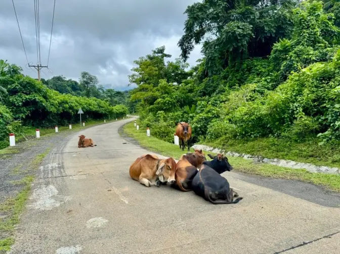
Common hazards specific to this road: buffaloes and cattle on the road in rural sections (slow down when you see them, do not sound the horn), concrete slab gaps at speed, loose gravel on mountain descents after rain, and fog on passes before 9 am. Ride the Sa Mù Pass descent at low speed if visibility is below 50 metres.
Photography stops worth planning around
The best light on the Sa Mù Pass is between 7 and 9 am before valley mist burns off. The Long Đại River Valley near Quảng Bình photographs well at golden hour from the old bridge crossings. The concrete-slab road cutting through jungle at the Khe Sanh to Phong Nha section creates clean minimalist compositions in overcast light. The Khe Sanh Combat Base museum grounds shoot well throughout the day but the aircraft and bunker structures are best in morning side-light.
Cycling the Ho Chi Minh Highway
The Ho Chi Minh Highway is one of the more popular long-distance cycling routes in Southeast Asia. The low traffic density on the central and northern sections makes it feasible for loaded touring bikes. Most cyclists ride south to north to use the prevailing tailwind from April to July. The full route from Ho Chi Minh City to Hanoi takes 35 to 50 days at a touring pace of 60 to 100 km per day.
The western central section between Khe Sanh and Phong Nha requires two days of cycling with camping or a basic guesthouse in between. Carry all food and water for each day from the last town, as services are absent for stretches of 60 to 80 km. The Sa Mù Pass at 1,000 metres is the hardest climb on the central section; the grade is steady rather than steep and most touring cyclists manage it without walking.
Accommodation infrastructure for cyclists is the same as for motorbike riders: guesthouses and homestays in the towns, very little in between. Camping is technically not prohibited in the national park buffer zones but is not formally provided for. Most cycle tourers use guesthouses where available and wild camp only when necessary.
FAQ: Ho Chi Minh Road motorbike guide
What is the difference between the Ho Chi Minh Road and the Ho Chi Minh Trail?
How long does it take to ride the Ho Chi Minh Road by motorbike?
What is the best section of the Ho Chi Minh Road to ride?
Where is the Ho Chi Minh Road on a map?
Can beginners ride the Ho Chi Minh Road?
What bike should I ride on the Ho Chi Minh Road?
Bottom line
The Ho Chi Minh Road is the quieter, more demanding, and more historically layered alternative to riding Highway 1 on the coast. The central section between Khe Sanh and Phong Nha is where the road earns its reputation: long fuel gaps, sparse services, jungle corridor, and near-total solitude. That same section also demands the most preparation. Riders who treat it casually, with a half-empty tank and no offline maps, run into preventable problems. Riders who plan it properly get one of the best days of riding in Southeast Asia.
The rest of the route, the southern plateau, the northern valley roads, and the day sections through Huế and A Lưới, is good riding by any standard. The historical sites sit directly on the road rather than requiring major detours. Two weeks covers the full route without rushing; one focused week covers the best of the central section from a coastal base.
About the author
Hamid is a Hanoi-based rider who has covered the Ho Chi Minh Road in both directions, across multiple seasons, on bikes ranging from a Honda XR150 to a BMW GS. He leads international motorcycle tours through Vietnam and Laos and focuses on the routes, stops, and road conditions that don’t make it into the standard guidebooks. His tours are reviewed by riders from Europe, North America, and Australia as among the most well-organised and route-knowledgeable in the region. When something goes wrong on a remote section of the western trail, he is the person other riders call.