So we were chatting last month about our trips up north, and honestly, the Ha Giang Loop came up like five times (as usual). One friend kept going on about those crazy limestone peaks around Dong Van with all these nature sites to explore. Said riding through there felt surreal. Another spent days wandering around Mu Cang Chai during harvest season, just stopping randomly to watch farmers work the terraces. Someone else did the Cao Bang route and wouldn’t shut up about Ban Gioc Waterfall. What’s cool is everyone did something different. Some tackled gnarly off-road stuff through Ma Pi Leng Pass, others just cruised easy through Mai Chau and Sapa villages, staying with local families. Whether you’re into hardcore mountain riding or just exploring ethnic minority areas at your own pace, Northern Vietnam’s got options for pretty much anyone wanting to get out there.
- Check out North Vietnam motorbike tours

Best Natural Areas for Motorbike Tours
Look guys, when people ask where to actually ride in Northern Vietnam, three spots keep coming up. Ha Giang province sits right at the Chinese border with those insane karst formations that look like they’re from another planet. The roads wind through valleys where you’ll pass Hmong villages every few kilometers. Then there’s the northwest circuit around Mu Cang Chai and Yen Bai, where rice terraces stack up mountainsides like giant green staircases.
Locals have been farming these slopes for centuries, and riding through during harvest season in September is spectacular. Cao Bang over in the northeast offers something different with dense jungle roads leading to massive waterfalls. The Ban Gioc area near the border gets less traffic than Ha Giang but delivers equally stunning scenery. Mai Chau valley works great if you want easier riding with plenty of valley views and Thai village homestays.
Sapa & Rice Terraces
Sapa sits around 1,600 meters up, so the temperature drops noticeably once you start climbing from the Red River valley. The ride up Highway 4D takes you through layer after layer of terraced fields, especially impressive around Muong Hoa valley. Red Dao and Black Hmong families still work these terraces daily, and you’ll see them out there in traditional dress regardless of weather.
The town itself gets crowded with tour groups, but ride 30 minutes in any direction and things quiet down fast. Cat Cat village sits just below town on a decent paved road, while Ta Van and Lao Chai require more careful riding on narrower paths. Fansipan looms over everything at 3,143 meters, though most riders skip the cable car and focus on the valley routes instead. September through November offers the best conditions with harvest colors and clearer skies.
Ha Giang Rocky Landscapes
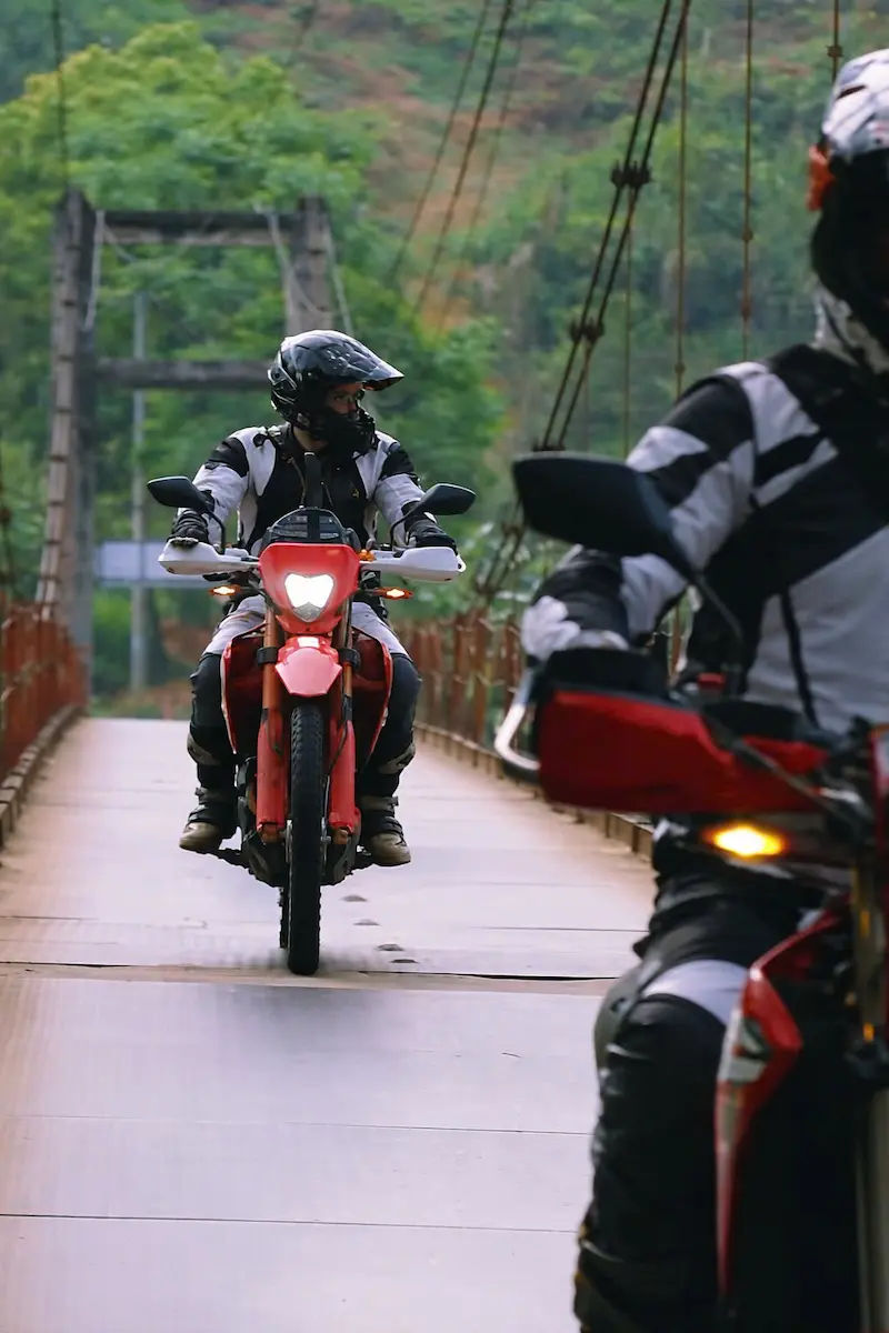
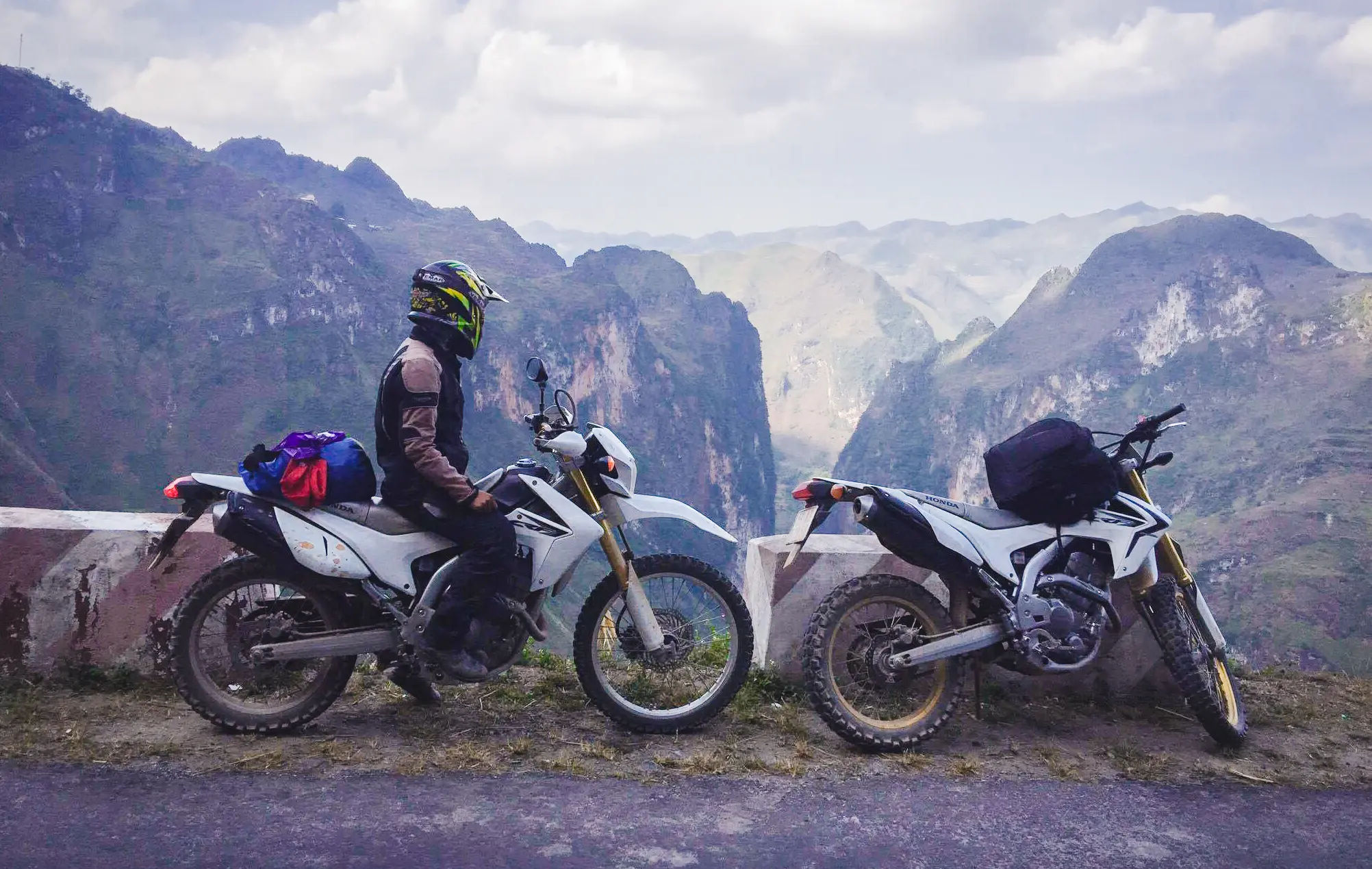
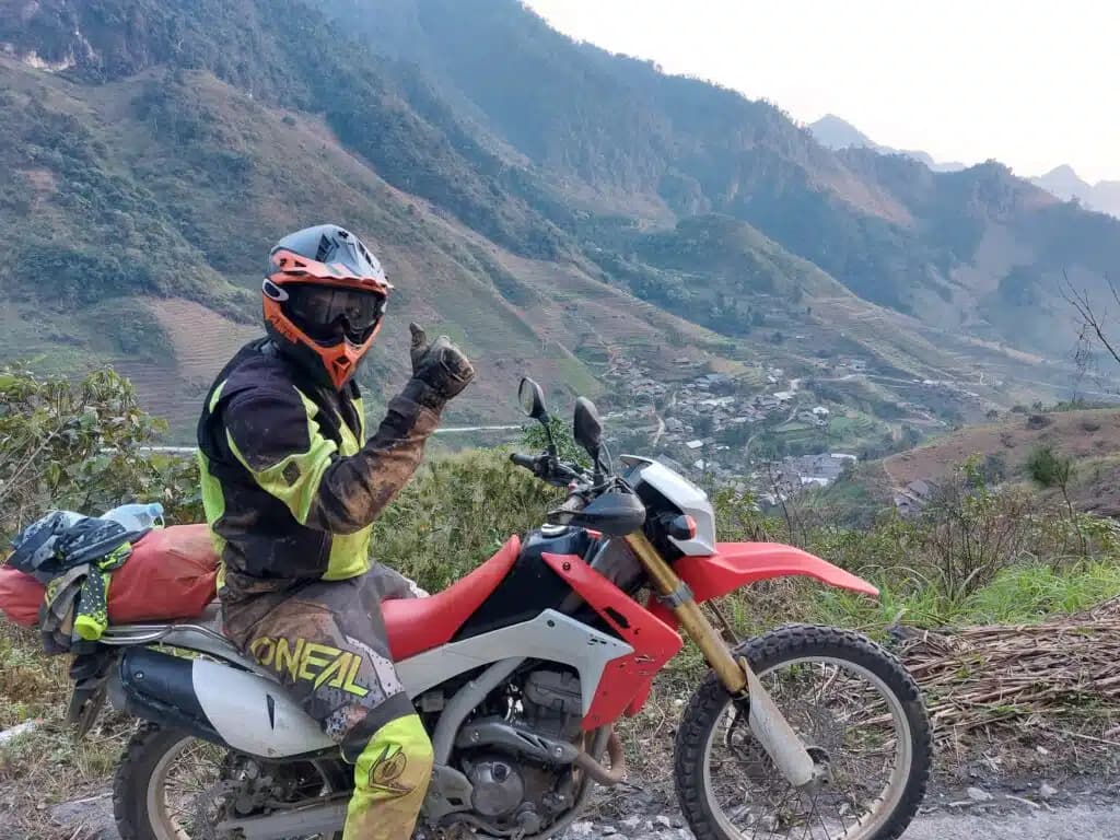
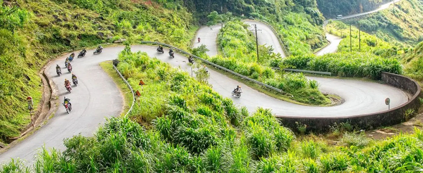
Ha Giang Loop has blown up over the past five years, and for good reason. The 350-kilometer circuit from Ha Giang city through Dong Van and Meo Vac delivers relentless mountain scenery. Dong Van Karst Plateau became a UNESCO Geopark in 2010, recognizing these 400-million-year-old limestone formations. Ma Pi Leng Pass cuts along cliffsides hundreds of meters above the Nho Que River, with exactly zero guardrails in several sections.
Quan Ba offers the twin mountains viewpoint called Heaven’s Gate, where most riders stop for photos. Lung Cu marks Vietnam’s northernmost point with a flag tower sitting on the actual border. The road quality varies wildly from smooth new asphalt to potholed mountain tracks. Most people take four days minimum, staying in Quan Ba, Yen Minh, Dong Van, and Meo Vac. Local guides know every viewpoint and can navigate the confusing intersections around smaller villages.
- Check out Riding motorbike in northern Vietnam’s rocky trails
- See 9 day ride from Hanoi to Hoi An
- Questions answered: Is the Ha Giang loop dangerous?
Popular Forest & Mountain Trails
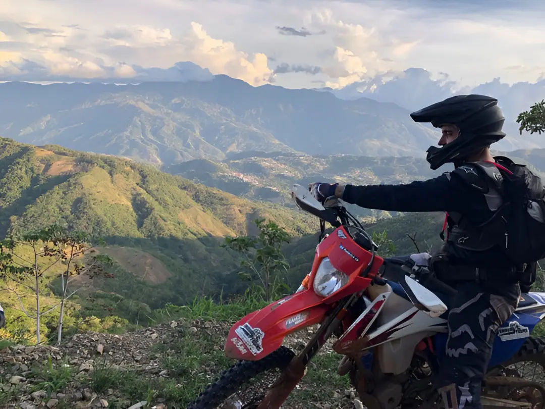
Mountain roads in Northern Vietnam split between paved highways and dirt trails pretty quickly once you leave main routes. Highway 32 from Tam Duong to Sapa cuts through Hoang Lien Son mountains with legitimate alpine forest at higher elevations. Ta Xua mountain near Bac Yen became popular around 2018 for cloud hunting, though the final climb requires parking and hiking.
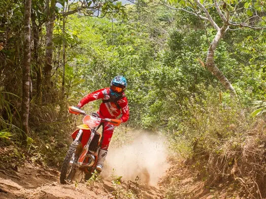
The Pha Din Pass on Highway 6 between Son La and Dien Bien Phu ranks among the longest continuous climbs in the region at 32 kilometers. Riders tackle switchback after switchback with forest covering both sides until breaking into open ridgelines near the top. Further east, the roads around Ba Be Lake thread through Limestone forests and occasional monkey sightings. Off-road options exist throughout Cao Bang province where single-track trails connect remote villages. Local riders use these daily on small bikes, but they challenge visitors unfamiliar with steep, loose surfaces.
- Check out top things to do in Ta Xua on a motorbike ride
- See 14 day motorcycle ride from Saigon to Hanoi
Ba Be National Park Trail
Ba Be Lake stretches eight kilometers long in Bac Kan province, surrounded by limestone cliffs and primary forest covering 23,000 hectares of protected parkland. The main road circles most of the lake on decent pavement, though getting there from Hanoi takes about six hours through increasingly rural roads.
Most riders base themselves in Pac Ngoi village where Tay families run guesthouses right on the water. From there, day trips hit Puong Cave where the Nang River flows directly through the mountain, Dau Dang Waterfall upstream, and An Ma temple tucked into forest above the village.
The park headquarters rents boats for lake tours if you want a break from riding. Trails into the surrounding hills range from easy walks to full-day treks requiring guides. Wildlife includes endangered Tonkin snub-nosed monkeys, though spotting them takes serious luck. The area sees far fewer visitors than Ha Giang or Sapa, making it ideal for riders wanting quieter nature exploration.
Natural Attractions Along Routes
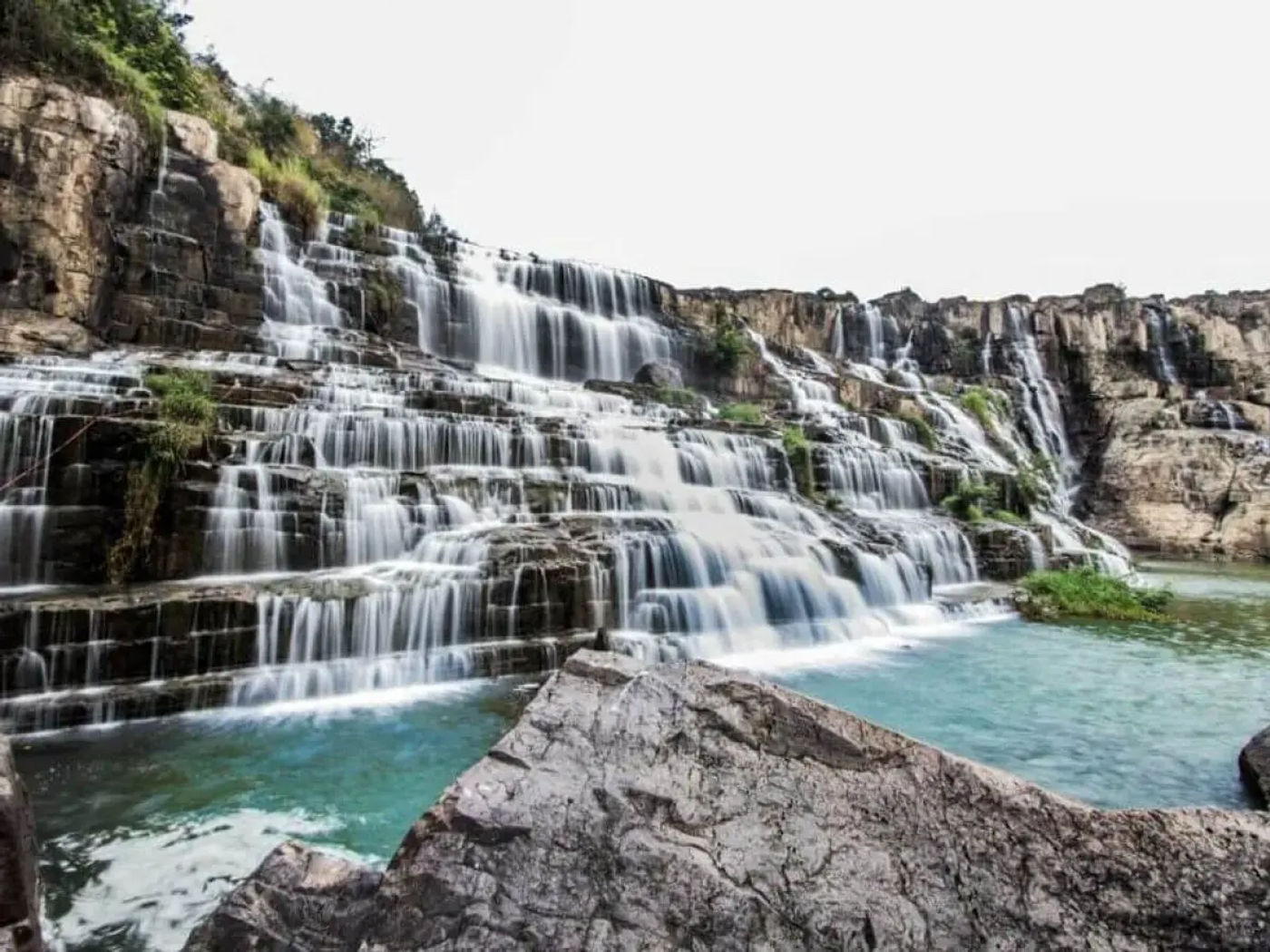
Waterfalls pop up constantly throughout Northern Vietnam’s mountain provinces. Ban Gioc near Cao Bang shares space with China across the border, dropping 30 meters over multiple cascades with bamboo raft tours getting you close to the falls. Thac Bac (Silver Waterfall) sits right on the Sapa highway, impossible to miss with parking areas on both sides. Love Waterfall requires a short detour and entrance fee but delivers better swimming opportunities.
Around Mai Chau, Mo Luong Cave and Chieu Cave offer cool breaks from riding with minimal crowds. The northeast region around Cao Bang features Nguom Ngao Cave stretching over 2,000 meters with lighting and walkways installed. Pac Bo Cave up near the Chinese border combines natural formations with historical significance as Ho Chi Minh’s 1941 headquarters.
Most attractions charge small entrance fees between 20,000 and 50,000 VND (USD 1-2 max)). Timing matters since waterfalls flow strongest during rainy season but roads become more challenging then.
- Check out Routes with best natural views in Vietnam
- See how to buy & register a motorcycle in Vietnam
- Here’s a 12 day Northern Vietnam motorbike adventure tour
Best Seasons for Nature Tours
September through November delivers the sweet spot for northern riding. Rice harvests turn terraces golden yellow, temperatures drop into comfortable ranges, and rainfall decreases significantly after monsoon season ends in August. October specifically offers peak conditions with clear skies and dramatic temperature shifts between valleys and mountain passes. Spring from March to May provides another solid window with blooming flowers and green terraces, though occasional rain showers still occur.
December through February brings stunning clear days but nighttime temperatures in places like Sapa and Ha Giang can drop near freezing, requiring serious cold weather gear. Summer from June to August sees heavy rainfall, particularly in July when roads flood regularly and visibility drops. Landslides become genuine concerns on mountain routes during peak rainy season. That said, summer also means lush green landscapes and fewer tourists if you can handle wet conditions. Local festivals cluster around Lunar New Year in late January or February when many services close down completely.
- Check out the best time to visit Vietnam from Australia
- See when’s the best month to ride the Ha Giang loop
Safety Tips & Essential Gear
Mountain riding in Vietnam requires different preparation than flat touring. Proper riding boots with ankle support matter more than fancy helmets since most accidents involve low-speed slides on gravel or mud. Speaking of helmets, ditch the cheap half-shells vendors rent and bring or buy a full-face model that actually fits. Gloves save your palms during inevitable minor drops.
Knee and elbow guards might look excessive but make sense on technical trails. Weather changes fast in mountains, so pack a rain jacket even on clear mornings. Sunburn hits hard at elevation, meaning sunscreen and long sleeves prevent misery later.
First aid basics like bandages, antiseptic, and pain relievers should stay accessible. Phone coverage drops to nothing in remote areas, so download offline maps beforehand. Cash runs essential since card readers don’t exist in small villages. Tool kits should include tire repair supplies, spare tubes, and basic wrenches matching your specific bike model.
- Read up: How to get a Vietnamese motorbike license in 2026
- Find out 7 day motorcycle adventure in far north
- Here’s the comprehensive detailed map of the Ha Giang
Trail Tools & Navigation
Google Maps works surprisingly well throughout Northern Vietnam, though it occasionally suggests insane shortcuts down footpaths. Maps.me offers better offline functionality with trail ratings from other users. Many riders swear by Guru Maps for detailed topography showing elevation changes before you hit them.
Download everything while you have wifi since mobile data disappears regularly in mountains. GPS coordinates help when asking locals for directions since village names get confusing fast with multiple places sharing identical names. Phone mounts need solid construction because vibration destroys cheap models within days on rough roads. External battery packs keep devices charged when guesthouses lack reliable power. Paper maps from local bookstores provide backup navigation and help explain routes when asking directions.
Screenshot key intersections and save them offline for quick reference. Vietnamese language basics help enormously, particularly numbers, directions, and simple questions about road conditions ahead. Local riders and shopkeepers generally know current road status better than any app and share information readily when asked respectfully.
- Check out Vietnam motorbike route guide from north to south
- Comparing Ha Giang & Cao Bang loop for a motorbike ride
Conclusion: Planning Your Northern Vietnam Ride
So that’s basically what you’re looking at up north to explore and ride along the amazing nature. Ha Giang delivers the dramatic stuff, Sapa handles terraces and culture, Ba Be gives you proper nature immersion. Weather matters more than people realize, so aim for September through November if possible. Gear up properly because mountain conditions change fast and help sits hours away in remote areas. Download your maps, pack cash, and maybe learn a few Vietnamese phrases. Whether you’re planning four days or four weeks, the routes stay rideable year-round with proper preparation. Most riders come back talking about doing it again, just taking different trails next time. Start planning and see what works for your schedule.
- Check out our best Vietnam motorbike tours
About the author
Hamid specializes in off-road nature tours across Northern Vietnam, guiding international riders through remote trails. With years of trusted experience exploring hidden routes, he helps adventurous travelers book authentic mountain experiences beyond typical tourist paths.