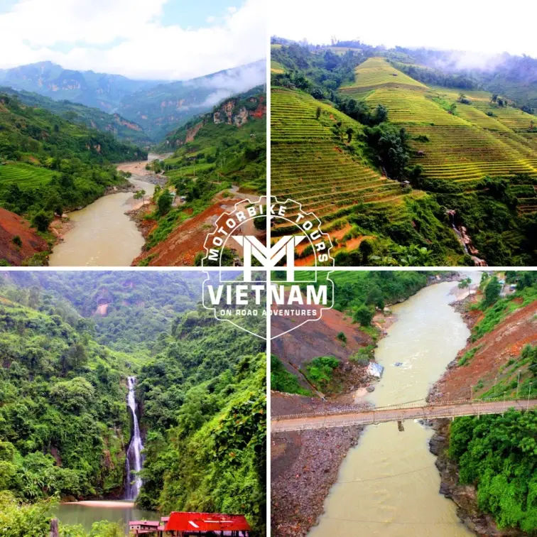
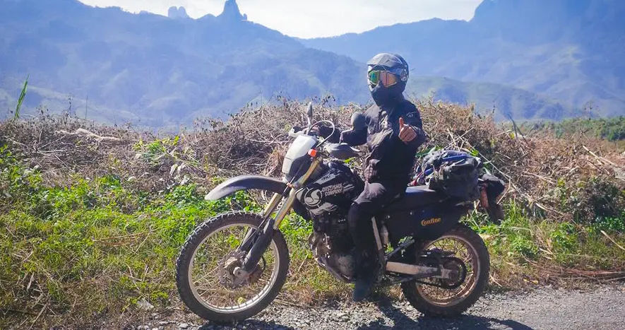
Forget the everyone’s to go trails as Northern Vietnam offers incredible off-road adventures beyond the popular Ha Giang Loop. Riders can explore Y Ty’s misty rice terraces and ethnic villages, Moc Chau’s sprawling tea plantations and seasonal blossoms, or the connecting route between Ba Be and Na Hang Lakes with pristine waterfalls and forest trails. Phong Nha’s jungle paths lead through cave systems, while Tua Chua provides steep climbs through remote highlands. For those seeking authentic experiences, alternatives like Pu Luong Nature Reserve, Cao Bang Circuit with Ban Gioc Waterfall, and Ta Xua’s cloud forests deliver stunning landscapes, cultural immersion, and true wilderness lesser-known riding routes away from tourist crowds.
- Lets explore Northern Vietnam motorcycle tours
Types of Hidden and Lesser-Known Trails in Northern Vietnam
Northern off-road network stretches far beyond the mainstream routes, offering riders a chance to discover trails that locals know best. These hidden paths wind through mountainous terrain where you’ll encounter ethnic minority villages untouched by mass tourism, terraced fields that cascade down steep hillsides, and roads that challenge even experienced riders. The diversity is remarkable.
You can tackle technical single-track sections through jungle, cruise along smooth tarmac with jaw-dropping valley views, or navigate dusty red dirt roads that test your bike handling skills. What makes these trails special isn’t just the scenery but the authentic interactions you’ll have along the way. Stop at a roadside stall in a Hmong village, share tea with a Tay family, or ask directions from farmers herding buffalo.
The terrain varies dramatically depending on the season, with monsoon rains transforming some routes into muddy challenges while the dry season opens up higher elevation passes. Most of these trails require a capable motorbike, preferably something with good ground clearance and reliable brakes for the steep descents.
Northwest Loop
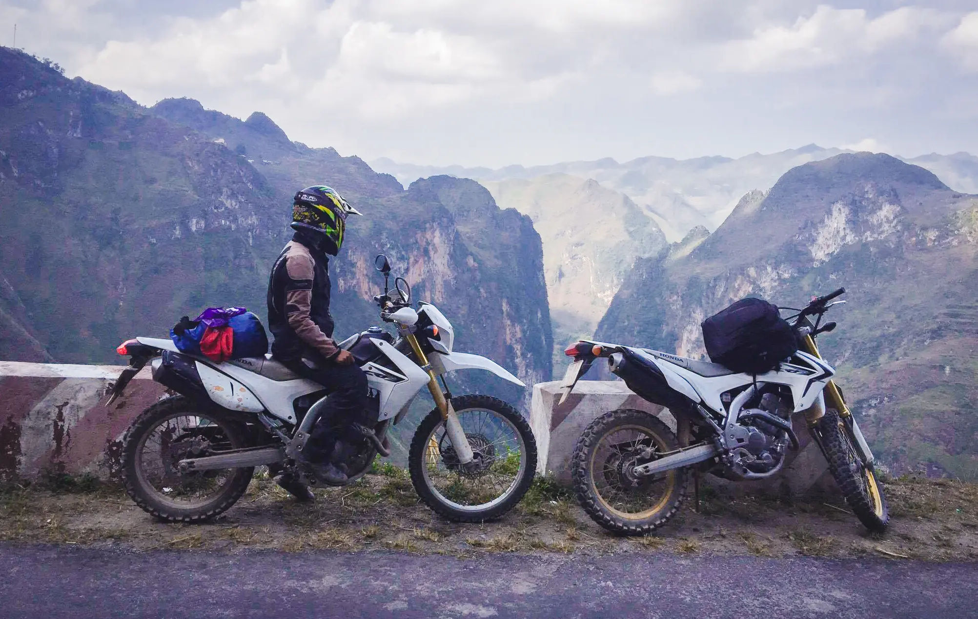
The Northwest Loop is a massive off the beaten track circuit that takes you through Lai Chau, Dien Bien Phu, and Son La provinces, covering territory that most travelers skip entirely. This route demands commitment because you’re looking at five to seven days of riding minimum, but the rewards justify every kilometer. Start from Hanoi and head toward Hoa Binh, then push northwest through Mai Chau before climbing into serious mountain country.
The section between Tuan Giao and Dien Bien Phu runs through some of the most remote highland areas in Vietnam, where Thai and Hmong villages sit scattered across valleys that seem untouched by modern development. Road conditions vary wildly. You’ll find decent QL279 connecting major towns, but venture onto smaller provincial roads like QL12 or DT128 and you’re dealing with potholes, loose gravel, and occasional landslide debris.
The landscape shifts constantly. One day you’re riding through endless tea plantations near Moc Chau, the next you’re navigating bamboo forests and river crossings. Fuel stations become scarce once you leave district capitals, so top up whenever possible and carry extra if your tank is small.
Ma Pi Leng Pass
Ma Pi Leng Pass sits along the Ha Giang Loop, but most riders blast through without truly experiencing what makes it special. This section of QL4C clings to cliff faces above the Nho Que River, with drops so steep they’ll make your palms sweat even if you’re comfortable with heights. The pass connects Dong Van to Meo Vac, running about 20 kilometers of pure adrenaline.
What catches people off guard isn’t just the exposure but the constant stream of tour buses and inexperienced riders who treat the narrow road like a racetrack. Early morning departures give you the best chance at having sections to yourself, plus the light at dawn turns the canyon walls golden. Stop at the viewing platform near the highest point, but also pull over at smaller spots where local H’mong women sell honey and medicinal herbs. The road surface is generally good, though landslides after heavy rain can leave debris scattered across lanes.
Riding downhill toward Meo Vac requires serious brake control because the descent is relentless. Some riders prefer tackling it in the opposite direction, climbing from Meo Vac, which gives you better visibility around blind corners and keeps you on the inside lane away from the cliff edge.
- Check out Comparing Sapa vs Ha Giang routes by difficulties
- See 12 day northern Vietnam adventure motorcycle travel
Khau Pha Pass
Khau Pha Pass ranks among Vietnam’s most dramatic mountain roads, yet it sees a fraction of the traffic compared to Ha Giang’s famous passes. Located on QL32 between Yen Bai and Mu Cang Chai, this beast climbs to nearly 1,500 meters through a series of hairpin turns that seem to go on forever. The ascent from the Yen Bai side is particularly intense, with gradients that will have you downshifting repeatedly.
What makes Khau Pha special is the surrounding landscape. During September and October, the rice terraces around Mu Cang Chai turn brilliant gold, creating a patchwork that’s visible from the pass. Tu Le village at the base is your last stop for fuel and food before committing to the climb. The road itself is well-maintained tarmac, but it’s narrow with limited guardrails, and logging trucks use this route regularly. Fog rolls in during late afternoon, reducing visibility to almost nothing, so plan your crossing for midday.
Coming down the northern side toward Mu Cang Chai town, you’ll pass through Hmong villages like Che Cu Nha and La Pan Tan where homestays offer basic accommodation. The shoulder season from March to May brings cooler temperatures and clear skies, ideal conditions for photography.
- Check out Night riding in northern Vietnam
- See Ho Chi Minh Road Motorbike tour from Hanoi to Saigon 15 days
Remote Ha Giang Trails
Beyond the standard Ha Giang Loop lies a network of trails that only adventure riders and locals know about. These routes branch off the main circuit, leading to places where Vietnamese tourists rarely venture, let alone foreigners. Take the road from Yen Minh toward Xin Cai village, a rough track that winds through limestone formations and stops at a Hmong settlement where kids will crowd around your bike with genuine curiosity. Another excellent detour runs from Lung Cu flag tower down to the valleys near Sung La, following dirt paths that require decent off-road skills.
The Hoang Su Phi area, technically outside the main loop but still in Ha Giang province, offers terraced landscapes that rival anything in Mu Cang Chai without the crowds. Provincial roads like DT176 and DT177 connect small districts but quickly deteriorate into rutted tracks once you leave town centers. Navigation gets tricky because signage is minimal and Maps.me or Google Maps often show roads that no longer exist or have been rerouted.
Villages like Thong Nguyen, Nam Hong, and Ban Luoc make good overnight stops where families run informal homestays. Expect basic conditions, squat toilets, and meals of whatever the family is cooking, usually rice with greens and maybe some pork or chicken.
- Check out routes with stunning natural views in Vietnam
- See 14 days motorbike trip from Saigon to Hanoi
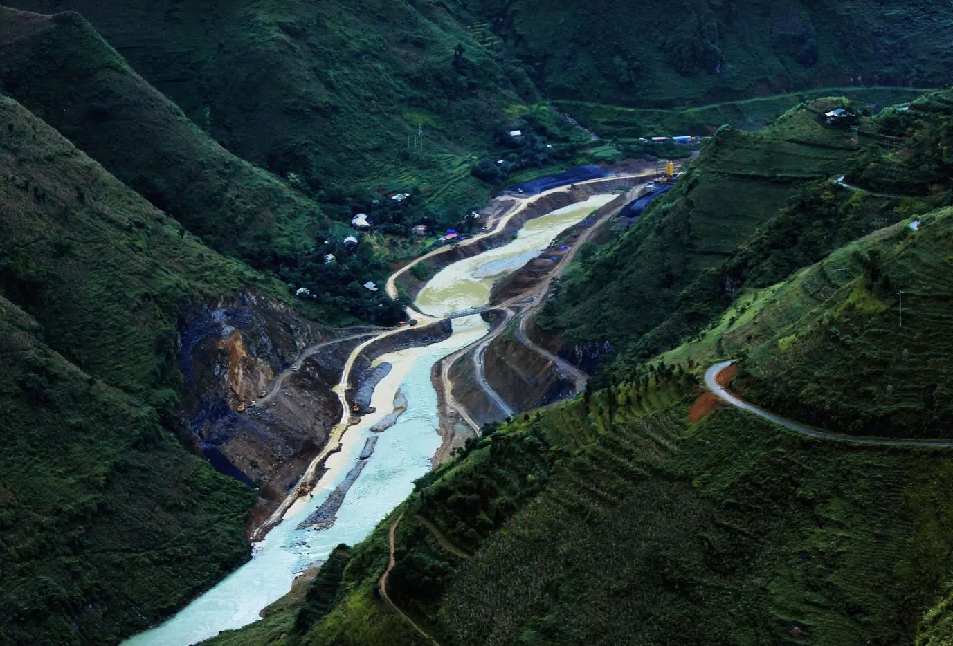
Ba Be – Na Hang Route
Tell you one thing, this is my favorite route for a weekend ride with mates. The Ba Be to Na Hang route connects two of northern Vietnam’s most pristine lake regions through mountains that feel genuinely remote. Start from Ba Be Lake in Bac Kan province, riding north on QL279 before cutting east on smaller provincial roads toward Tuyen Quang.
This isn’t a quick blast, expect a full day of riding to cover roughly 120 kilometers, more if you explore side trails. The road quality shifts constantly. Some sections offer smooth new tarmac laid down for hydroelectric projects, others revert to rutted dirt that turns into mud slicks after rain. You’ll pass through Tay and Nung villages where wooden stilt houses overlook the road and locals dry corn on bamboo racks. Around the halfway point, stop in Cho Ra or Chiem Hoa district towns for lunch and fuel. The approach to Na Hang Lake is spectacular, with the road descending through forest before the water comes into view.
Unlike Ba Be which has developed some tourism infrastructure, Na Hang remains quieter with fewer accommodation options. Try homestays in Ban Coc village or the small guesthouses near the dam. The best time for this route is October through April when rivers are lower and roads are passable. During monsoon season from May to September, flooding can cut sections entirely.
- Checkout multi-day adventure routes in northern Vietnam
- See Hanoi to Ho Chi Minh City motorcycle tours
The Most Challenging Trails You’ll Face
Northern trails toughest trails separate casual riders from those ready to push their limits and their bikes to the edge. These aren’t Sunday cruises along coastal highways. You’re dealing with technical terrain that demands concentration, proper gear, and honest assessment of your skill level. The challenges come in different forms. Sometimes it’s the gradient, climbs so steep you’re standing on the pegs just to keep weight over the front wheel.
Other times it’s surface conditions, red clay that becomes skating rink slippery when wet, or loose gravel on descents where braking too hard means sliding out. Then there’s the exposure factor, narrow tracks carved into mountainsides where one mistake puts you over the edge. What catches riders off guard is how quickly conditions change. A trail that’s perfectly rideable in dry season becomes a muddy nightmare after a few hours of rain.
The remoteness adds another layer of difficulty. Break down on some of these routes and you might wait hours before another vehicle passes. Cell service disappears entirely in valleys and high passes. Local mechanics in small towns can fix basic problems but don’t expect specialized parts or advanced diagnostics. Riding these trails solo isn’t recommended unless you’re experienced and properly equipped with tools, spare tubes, and emergency supplies.
- Check out Tips for beginners riding motorbike in Vietnam
- See 9 day Ho Chi Minh Trail ride – Hanoi to Hoi An
Steep Slopes & Slippery Tracks
The steepest climbs in the areas will have you questioning your bike choice and maybe your life decisions. Routes like the ascent to Tram Ton Pass on QL4D hit gradients that feel nearly vertical, especially on the Sapa side where the road kicks up relentlessly for about 15 kilometers. Your clutch hand will cramp, your engine will overheat if you’re on an underpowered bike, and you’ll need to pick smart lines to maintain momentum.
Coming down is often worse than going up. The descent from O Quy Ho toward Lai Chau requires constant brake management because if you cook your brakes halfway down, you’re in serious trouble on the remaining switchbacks. Slippery conditions multiply the difficulty. The red clay soil common around Mu Cang Chai and Yen Bai provinces turns into slick mud that offers zero traction when wet. Even experienced riders find themselves sliding sideways on seemingly gentle corners. The worst sections are shaded forest tracks where moisture never fully evaporates, leaving a permanent greasy layer on the surface.
The lesser-known roads around Xin Man and Hoang Su Phi become particularly treacherous during rainy season. Local riders often stop and wait out heavy downpours rather than risk it. If you must ride in wet conditions, drop your tire pressure slightly for better grip, stay off the front brake as much as possible, and keep your weight back on descents. Crossing streams adds another element, water levels can rise dramatically after storms, turning ankle-deep crossings into knee-deep challenges where one wrong move means a dropped bike and soaked bags.
- Check out Sapa’s best routes for motorbike riders
- See North Vietnam motorbike tour with Ha Giang Loop
Border Trails: Stunning but Sensitive
The trails running along Vietnam’s borders with China and Laos offer some of the most spectacular and least visited riding in the north, but they come with complications you need to understand before heading out. The Chinese border region around Cao Bang, Ha Giang, and Lao Cai provinces has military checkpoints and restricted zones where foreigners need special permits or are simply not allowed.
The road from Bao Lac to Cao Bang on QL34 parallels the border for long stretches, passing through areas where you’ll see border markers and patrol stations. Most checkpoints wave tourists through without issue, but some require inspection of your passport and vehicle documents. Don’t photograph military installations, border markers, or checkpoints as this causes problems immediately.
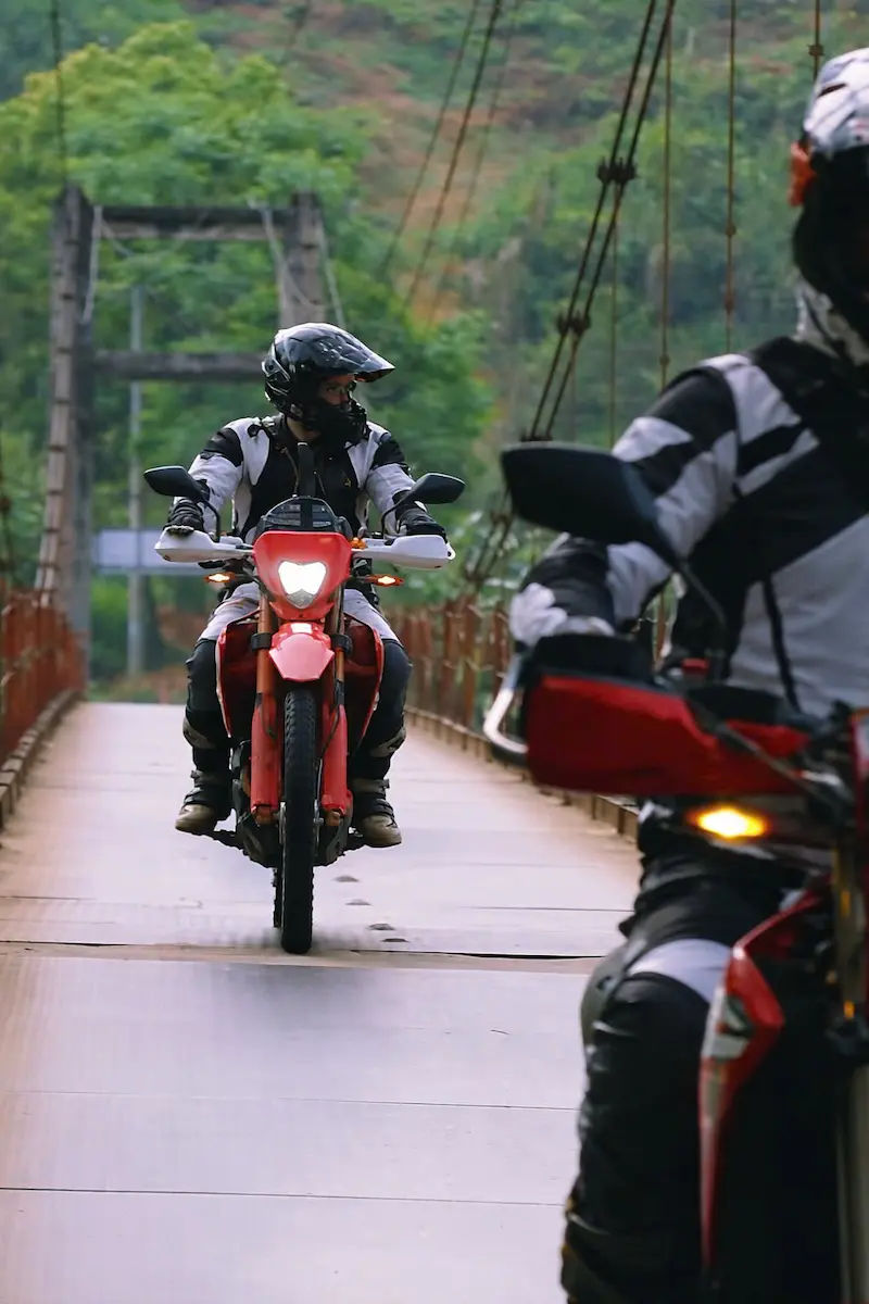
The western border trails near Dien Bien Phu and Lai Chau toward Laos are less restricted but equally remote. QL128 running north from Dien Bien Phu toward Sin Ho passes through territory where Hmong and Dao communities maintain traditional lifestyles. These border regions are stunningly beautiful precisely because development has been limited. You’ll ride through pristine forests, cross rivers on sketchy concrete bridges, and climb passes where you can see into Chinese territory. Villages like Lung Cu near the northernmost point or Pac Bo cave area near Cao Bang offer border proximity without major restrictions.
Always carry your passport, bike registration, and international driving permit. Keep copies separate from originals.
- Check out Riding on rocky trails in northern Vietnam
- See Off-road motorbike adventure in Ha Giang Mountains
What’s the best Season for a safe ride?
Timing your ride through northern Vietnam dramatically affects both safety and enjoyment. The optimal window runs from October through April when weather is cooler, rainfall is minimal, and visibility stays clear. October and November are particularly good because the rice harvest creates golden terraces around Mu Cang Chai, Ha Giang, and Hoang Su Phi, plus temperatures at altitude remain comfortable during the day.
December through February brings cold weather, especially at higher elevations. Passes like Tram Ton and Khau Pha can drop below freezing at night, and morning frost makes roads slippery until the sun warms things up. Pack proper layers because what’s comfortable in the valleys becomes painfully cold at 2,000 meters. March and April offer warming temperatures and clear skies, though April marks the beginning of the transition toward monsoon season. From May through September, heavy rains hit the northern mountains hard. This isn’t just inconvenient, it’s genuinely dangerous. Landslides become common on mountain roads, sometimes blocking routes entirely for days.
The red clay roads turn into impassable mud. River crossings that are easy in dry season become raging torrents. Fog at altitude can reduce visibility to meters, making passes like Ma Pi Leng genuinely hazardous. If you must ride during wet season, start early each day before afternoon storms roll in, avoid riding after dark completely, and build flexibility into your schedule for weather delays. Check with local riders and guesthouse owners about current road conditions.
They’ll know if recent landslides have closed sections or if a particular pass is currently impassable. Some routes like the Ba Be to Na Hang road become completely cut off during peak monsoon, turning a day ride into a multi-day nightmare.
- Check out the best time to ride the Ha Giang Loop
- Also, see when is the best time to visit Vietnam
Culture & Local Life Along the Way
The real magic of northern Vietnam’s trails isn’t just the scenery but the people you meet along the way. Ethnic minorities like the Hmong, Dao, Tay, and Thai make up most of the population in these mountain regions, each with distinct languages, clothing, and traditions. Stop in villages and you’ll see daily life that hasn’t changed much in generations.
Women weave intricate textiles on wooden looms, men repair terraces by hand, and kids herd buffalo after school. Markets buzz with activity where locals trade vegetables, medicinal herbs, and livestock. The Sunday market in Bac Ha explodes with color as different ethnic groups converge wearing traditional dress. Can Cau market near the Chinese border offers a more authentic experience with fewer tourists. Simple interactions matter most.
Share a meal, attempt a few Vietnamese phrases, or help push a broken motorbike. These moments create connections that make the journey memorable beyond just ticking off scenic viewpoints.
- Check out nightlife in Hanoi and northern Vietnam
- See Top Gear Vietnam Special, a 23 day ride top to toe
Village Stays & Local Markets
Homestays in remote villages offer experiences no hotel can match. Families open their homes, usually wooden stilt houses with basic sleeping mats and shared bathrooms. Expect squat toilets, cold water showers, and communal dinners where everyone eats together.
The food is simple but genuine, rice with stir-fried greens, maybe chicken or pork, and corn wine if you’re willing. Villages around Hoang Su Phi, Pu Luong, and Ba Be have established homestay networks where families are accustomed to guests. Payment runs about 150,000 to 250,000 VND including meals. More remote spots like those along the Cao Bang circuit might not have formal arrangements, just ask at the village headman’s house and someone usually volunteers space. Markets operate on specific days, typically once or twice weekly.
Coc Ly market on Tuesdays, Cao Son market on Wednesdays, and Xin Man market on Sundays all draw ethnic minorities from surrounding areas. Arrive early because trading starts at dawn and winds down by midday as people trek back to their villages.
- Check out Local festivals in northern Vietnam
- Visit historical sites in northern vietnam on a motorbike trip
Essential Tips for a Smooth Off-Road Trip
Preparation makes the difference between an adventure and a disaster on northern Vietnam’s remote trails. Your bike needs to be mechanically sound before departing. Check tire tread depth, brake pads, chain tension, and oil levels. Carry essential spares including spare tubes, tire levers, a patch kit, clutch and throttle cables, and basic tools.
A small first aid kit, water purification tablets, and energy bars cover emergencies when you’re hours from the nearest town. Pack light but smart. Waterproof bags protect electronics and documents. Layers work better than bulky jackets since temperatures swing dramatically between valleys and mountain passes. Cash is essential because ATMs disappear outside provincial capitals and many villages operate entirely on cash.
Keep small denominations, 20,000 and 50,000 VND notes, for buying fuel from homes or paying for homestays. Download offline maps on Maps.me or Google Maps before leaving connectivity. Physical maps help but road numbers often don’t match what’s actually signposted. Fuel management requires attention. Fill up in every town even if your tank is half full.
- Check out Fuels in Vietnam
- See BMW Motorrad Tours in Vietnam
How to Navigate – Should You Hire a Guide?
Navigation in northern Vietnam challenges even experienced riders because signage is inconsistent and roads don’t always match what maps show. GPS helps but has limitations. Offline maps on Maps.me generally work better than Google Maps in remote areas, though both occasionally show roads that have been rerouted or no longer exist.
The safest approach combines digital navigation with local knowledge. Stop frequently and ask directions, even if you think you know the way. Locals are remarkably helpful once you get past language barriers. Point at your map, say the destination name, and they’ll gesture which direction to go. Hiring a guide makes sense depending on your experience and route ambition. For standard loops like Ha Giang, guides aren’t necessary since the main roads are well-traveled and other tourists can help if you get lost.
For remote trails like deep Ha Giang detours, the Ba Be to Na Hang route, or border regions, a local guide provides real value. They know current road conditions, which villages offer homestays, and how to handle checkpoints. Local guides typically ride their own bikes and cost around 1000,000 to 2,000,000 VND per day depending on difficulty and duration.
- Check out Traditional Vietnamese dishes to eat on a motorbike ride
- See Staying in northern Vietnamese villages on a motorbike trip
Safety Tips for High-Risk Trails
High-risk trails demand respect and proper precautions because help can be hours away when things go wrong. Ride within your skill level honestly. That technical single-track might look exciting but if you’re not confident in loose dirt or steep descents, skip it and take the longer route.
Proper gear isn’t optional. A quality helmet, gloves, sturdy boots, and abrasion-resistant clothing protect you when you go down, and on challenging trails, going down is often a matter of when not if. Knee and elbow pads add protection without much bulk. Never ride alone on genuinely remote sections.
Pair up with another rider so someone can get help if there’s an accident or mechanical failure. Morning starts beat afternoon departures because you avoid the hottest part of the day and reduce chances of getting caught in sudden storms. Watch for warning signs like fresh landslide debris, damaged guardrails, or locals warning you off a route. They know conditions better than any map. Maintain safe following distances behind other bikes because dust clouds obscure vision and sudden stops happen constantly on rough trails.
FAQs: Conquering North Vietnam Off The Beaten Path
What not to miss in northern Vietnam?
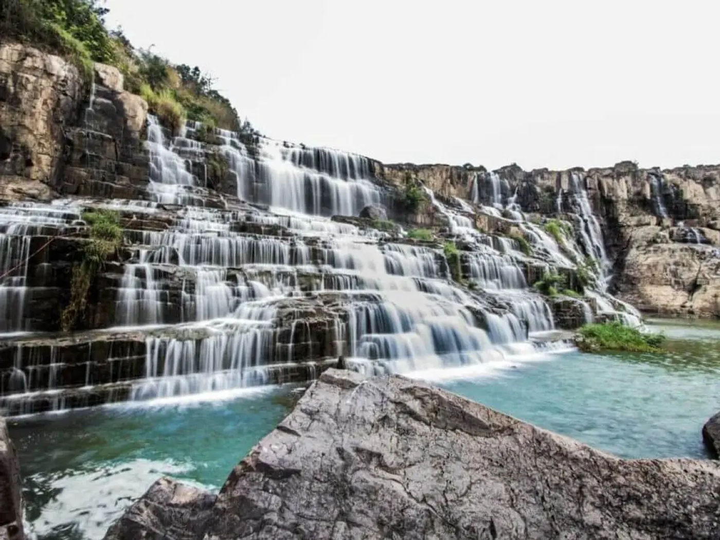
Don’t miss the rice terraces in Mu Cang Chai during harvest season, Ban Gioc Waterfall near Cao Bang, Ma Pi Leng Pass for dramatic cliff views, ethnic minority markets like Bac Ha, and Ba Be Lake’s pristine nature. Khau Pha Pass and remote villages in Hoang Su Phi offer authentic cultural experiences away from tourist crowds.
What are the most famous motorbike circuits in North Vietnam?
The Ha Giang Loop is the most famous, followed by the Northwest Loop through Dien Bien Phu and Son La. The Cao Bang Circuit featuring Ban Gioc Waterfall is gaining popularity, while the Mai Chau to Moc Chau route offers easier riding through scenic valleys and tea plantations.
Where to go instead of Sapa & Ha Giang?
Try Mu Cang Chai for stunning terraces without the crowds, Pu Luong Nature Reserve for peaceful valleys and homestays, Hoang Su Phi for authentic village life, or the Ba Be to Na Hang route for pristine lakes and forests. Moc Chau and Y Ty offer highland scenery with fewer tourists.
Bottom line: Why These Routes Are Worth It?
These lesser-known trails deliver what mainstream routes can’t anymore: genuine discovery and authentic encounters. You’ll ride for hours seeing maybe five other motorbikes, all locals going about their lives. The challenges make arriving in each village feel like an achievement rather than just another stop.
The landscapes are stunning, sure, but it’s the unplanned moments that stick with you. Sharing tea with a Hmong grandmother, getting directions through elaborate hand gestures, fixing a flat tire while village kids watch fascinated. These routes demand more effort and better planning, but that’s exactly why they remain special. Check out out best Motorbike Tours in Vietnam for 2026
About the author
Hamid specializes in off-road trails and off the beaten track routes across Vietnam, connecting with locals and international riders alike. His insights help Vietnam bikers discover the best hidden paths worth exploring.