Lesser-Known Routes in Northern Vietnam: Hidden Motorcycle Roads & Backroads Guide
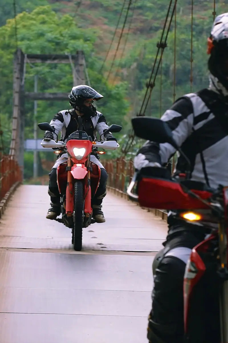
Most travelers stick to the same well-worn paths through Northern Vietnam, but there’s a whole different world waiting just off the main routes. We’re talking about mountain passes where you might go hours without seeing another traveler, rice terraces that rival anything you’ve seen in photos but without the tour buses and the masses of backpackers so called “easy riders”,or villages where people still seem genuinely surprised to see outsiders. This guide covers the lesser-known mountain ranges, highland villages, nature reserves, and waterways that don’t make it onto most itineraries. From the challenging climbs through the Hoang Lien Range to the peaceful waters of Ba Be Lake, from cloud-covered Y Ty to the dramatic waterfalls near Cao Bang, these routes let you experience Northern Vietnam without fighting for photo spots or following lines of other travelers.
- Check out Northern Vietnam best motorbike tours
Lesser known routes in northern vietnam (The Map)
Hidden Trails Away from Tourists
Northern Vietnam’s hidden trails offer something most popular routes can’t deliver anymore: genuine solitude and the thrill of discovery. These paths wind through landscapes that look like they’ve been pulled from a different era, where local farmers still stop to wave at passing travelers because they’re not yet tired of seeing outsiders.
The roads themselves often tell a story, built by local communities and maintained just enough to stay passable, giving you that raw adventure feeling without crossing into genuinely dangerous territory.What sets these trails apart is how they connect remote communities that tourism hasn’t changed yet. You’ll pass through areas where traditional ways of life continue undisturbed, where markets still operate on centuries-old schedules, and where evening meals with families happen naturally rather than as paid homestay experiences.
The scenery shifts dramatically as you navigate these routes, from dense bamboo forests that create natural tunnels overhead to sudden clearings that reveal valley views stretching for miles. Weather plays a bigger role here too, with morning fog often clearing to reveal landscapes you had no idea surrounded you, and afternoon clouds rolling in to create an entirely different atmosphere.
These trails demand more attention and respect than paved highways, but they reward that attention with experiences you’ll remember long after the easier routes have blurred together in your memory.

Hoang Lien Mountain Range
The Hoang Lien range cuts through northern Vietnam like a massive granite spine, with Fansipan (3,143m) sitting at its crown as Indochina’s highest peak. Highway 4D runs along the eastern flank while Road DT152 cuts through the heart of the range, creating some of Vietnam’s most dramatic mountain passes and technical riding terrain.
You’ll tackle the famous Tram Ton Pass on Highway 4D, which tops out at 2,000m and drops through countless switchbacks wrapped in cloud forest. The roads wind through Hmong and Dao villages where locals still wear full traditional dress daily. Mornings bring thick fog that clings to valleys until mid-morning, so plan your riding accordingly.Temperature drops significantly as you climb on these routes, sometimes 10 degrees cooler than valleys below.
The range creates its own weather patterns, meaning sudden rain squalls even in dry season. Roads are mostly paved but deteriorate quickly after heavy rains.
Y Ty (Lao Cai)
Y Ty sits at 2,000m elevation right against the Chinese border, accessible via Road QL4D and then the steep DT154 turnoff near Bat Xat. The 70km ride from Lao Cai city takes you through genuinely remote territory where pavement ends and proper dirt roads begin. This isn’t a day trip spot, it’s a commitment ride requiring decent off-road skills.
The Ha Nhi people dominate here, living in traditional wooden houses perched on steep mountainsides. The final 20km stretch on local roads becomes challenging in wet season when clay turns into slick skating rinks. Local guesthouses are basic but genuinely welcoming, run by families who’ll feed you proper mountain food like thang co and corn wine.Phone signal is patchy at best, so download maps before heading up Highway 4D.
The ride back down offers better views than going up, with the entire Muong Hum valley spreading below you. Morning fog usually clears by 10am, giving perfect visibility for photographs.

Mu Cang Chai
Mu Cang Chai sits in Yen Bai province along Highway 32, creating natural amphitheaters of rice terraces that cascade down valley walls. The main loop includes Road DT152 connecting to famous Khau Pha Pass, which climbs to 1,200m with hairpin turns that photographers dream about. September and October are peak season when rice turns golden before harvest.
The 200km circuit combines Highway 32 with DT152 and smaller connecting roads through La Pan Tan and Che Cu Nha villages. Road quality is surprisingly good, fully paved and well maintained because this has become a showcase route.
Tu Le town on Highway 32 provides the main service hub with mechanics, fuel, and supplies. Villages offer homestays where you’ll sleep on wooden floors and wake to valley views. Weekends during harvest season get crowded with domestic tourists, so midweek riding gives you more space. Weather here is unpredictable, with clouds rolling in fast and temperatures swinging 15 degrees in an hour.
- Check out Multi-day adventure routes in Northern Vietnam
- 12 day Northern Vietnam motorcycle adventure tour
Hoang Su Phi
Hoang Su Phi in Ha Giang, offers spectacular terraced fields with fewer visitors than Mu Cang Chai. Road QL2 from Vinh Quang leads to DT176, which winds 60km through Ban Luoc and Ban Phung past 700-year-old rice terraces built by Nung, Dao, and Tay communities. The road is in decent on main routes but expect rough patches and occasional road work.
The terraces here step down into deeper valleys than Mu Cang Chai, creating dramatic vertical drops and better morning light. Highway 2 provides the main access artery before you turn onto smaller mountain roads. Accommodation is mostly homestays, more rustic than better-known areas.
Families here are still getting used to tourists, which means authentic interactions but challenging communication. Roads connect to Ha Giang’s famous loop via DT176, making this a good add-on for riders wanting to escape the main backpacker trail. Fuel stations appear every 40km on Highway 2 and main routes, enough to keep you moving but don’t run your tank empty.

Pu Luong Nature Reserve
Pu Luong offers mountain scenery without extreme altitudes, located in Thanh Hoa province at 600 to 1,000m elevation. Road QL15C from Mai Chau provides the main access, while Road DT523 loops through the reserve interior past Kho Muong and Hieu villages. The limestone karst formations create natural caves, underground rivers, and dramatic cliff faces along these 70km routes.
You’ll cross bamboo waterwheels on local roads that locals use for irrigation, some over 100 years old and still functioning. The Thai ethnic minority villages practice traditional stilt house architecture raised 2-3 meters off the ground. Roads through Pu Luong on QL15C and DT523 are generally good condition, though narrow where only one vehicle can pass.
Rainy season from May to September makes some sections slippery but nothing too technical. This area is becoming popular for trekking tourism, so expect more homestays and small restaurants than remote mountain regions. Village homestays offer proper beds, mosquito nets, and private bathrooms as standard.
Ba Be Lake & the National Park
Ba Be Lake sits 145m above sea level in Bac Kan province, accessible primarily via Highway 3 (QL3) from Hanoi covering 240km of well-paved road. The final approach uses Road DT254 which drops into the lake basin through forested mountains. This massive freshwater lake stretches 8km long and reaches 35m depths, surrounded by limestone mountains covered in primary forest.
The ride from Hanoi on Highway 3 takes about 6 hours, with the turnoff to DT254 well marked near Cho Ra. Tay ethnic villages dot the lakeshore, with Pac Ngoi village serving as the main base for wooden homestays. Road QL3 is well maintained year-round, making this accessible even for less experienced riders.
Boat trips from the village take you to Puong Cave and Dau Dang Waterfall. Road conditions around the lake on DT254 are decent concrete paths connecting villages. Bo Lu town on Highway 3, about 18km from the lake, provides fuel and supplies. Local cuisine features cá anh vũ, a fish species endemic to Ba Be.
- Check out Beginner tips for riding a motorbike in Vietnam
- 9 day Ho Chi Minh Trail motorbike ride from Hanoi to Hoi An
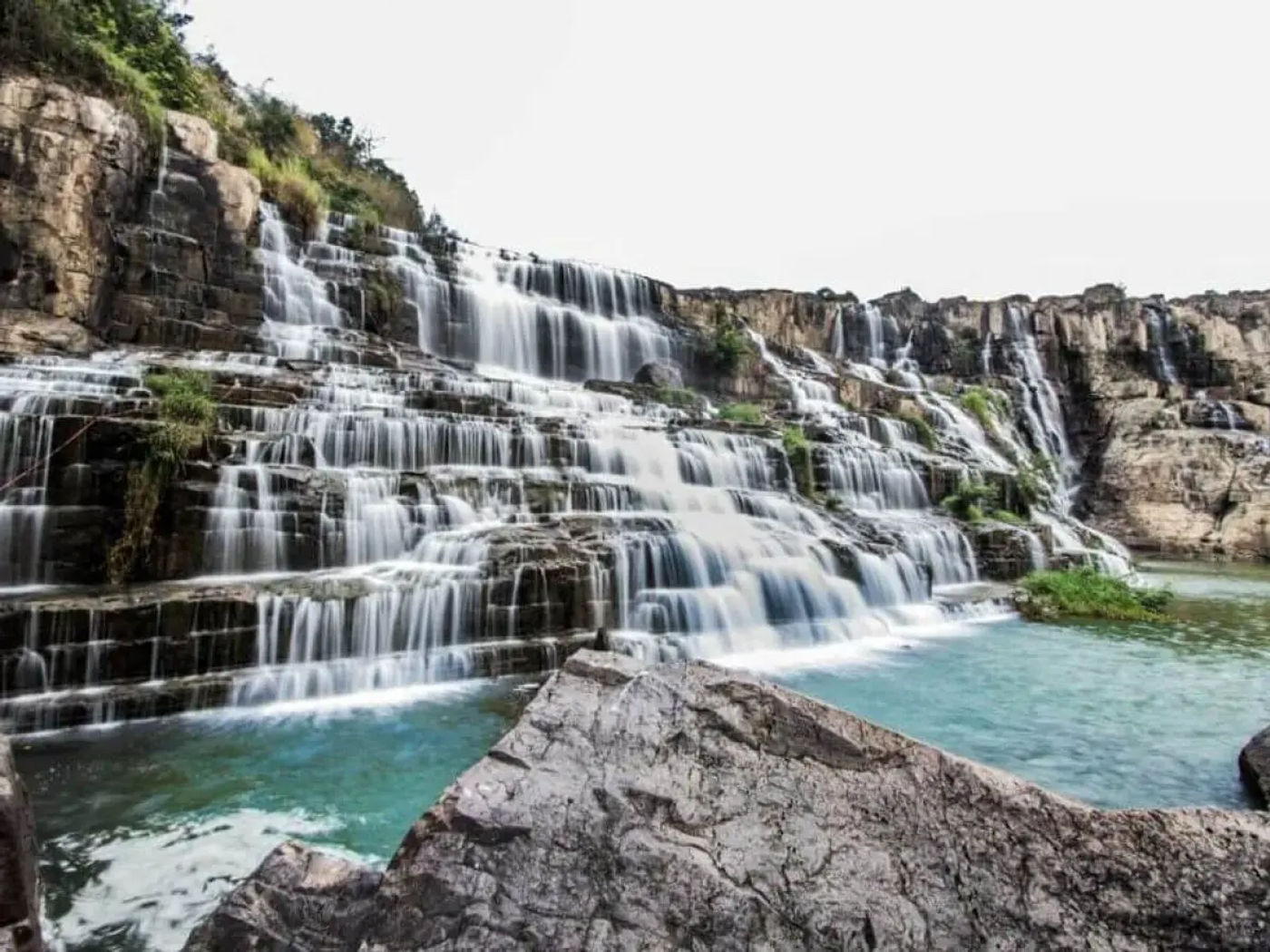
Cao Bang Geopark & Ban Gioc Waterfall
Cao Bang province shares a long border with China, with Road QL4A providing the main access route from Cao Bang city. The 85km ride to Ban Gioc Waterfall follows Highway TL206 along the Quay Son River valley, passing through Nung and Tay villages where limestone cliffs tower overhead. The falls span 300m wide, sitting directly on the Vietnam-China border.
The road quality on QL4A and TL206 is excellent, fully paved and smooth because this route sees regular tourist traffic. Highway 203 offers an alternative scenic route through the geopark interior. Nguom Ngao Cave sits 3km from the falls on local roads off TL206, featuring a 2km cavern system with stalactites and underground rivers.
Accommodation clusters around Trung Khanh town on Highway 4A and near the falls themselves. The area gets busy on weekends with domestic tourists, so midweek visits offer more space. Fuel stations are regular along QL4A and TL206 but become sparse on side roads. The geopark has dozens of other waterfalls accessible via smaller roads branching from the main highways.
- Check out Sapa’s best adventure routes for motorbike riders
- See North Vietnam motorbike ride with Ha Giang loop
Thac Ba Lake & Tuyen Quang
Thac Ba Lake is an artificial reservoir in Yen Bai province, accessible via Highway 32 (QL32) from Yen Bai city. Road DT175 branches off Highway 32 and circles portions of the lake perimeter, offering constant water views through gaps in vegetation. The 1971 hydroelectric dam created 23,000 hectares of water surface with over 1,000 small islands where Dao ethnic communities now live.
The main access point is Yen Binh town on Highway 32, where boats ferry people and motorbikes between mainland and islands. Roads around the lake perimeter on DT175 are paved but narrow, with sections that drop steeply to the waterline. Provincial Road 173 (DT173) connects the southern lake areas to Tuyen Quang city, about 50km south, which serves as a logical base with proper hotels.
The route between Tuyen Quang and Thac Ba on Highway 37 (QL37) passes through agricultural valleys growing tea and fruit trees. Homestays on the lake islands offer authentic experiences but require advance booking and boat transport for your bike.
- Check out guide to ride on rocky trails in Northern Vietnam (with detailed map)
- Off-road motorbike adventure in Ha Giang Mountains
Hidden Quan Ba Loop
The Hidden Quan Ba Loop breaks away from Ha Giang’s crowded main circuit, using Road DT217 and smaller village roads to explore the area around Quan Ba’s famous Twin Mountains. This 40km loop starts from Tam Son town on Highway 4C (QL4C) and winds through less-visited Tay and Hmong villages where tourist infrastructure remains minimal. The route circles back via local roads that connect small hamlets like Lung Tam and Thanh Van.
Road DT217 offers surprisingly good pavement for the first 25km before transitioning to concrete village paths that require more attention. The Twin Mountains viewpoint sits right on Highway 4C, but the real scenery unfolds once you turn onto DT217 where terraced fields cascade down valley walls without the tour buses. Local roads here are narrow, sometimes barely two meters wide, with tight turns around traditional wooden houses.
You’ll encounter fewer services on this loop compared to the main Ha Giang route. Fuel up in Tam Son before starting, as the next reliable station sits 40km away. Village shops sell basics like instant noodles and drinks, but don’t expect English menus or tour-ready homestays. The locals here are genuinely surprised to see foreign riders, making interactions more authentic but also requiring patience and basic Vietnamese phrases.
Morning rides work best when visibility is clear for photographing the karst landscape. The loop connects back to Highway 4C, allowing you to continue north toward Yen Minh or return south toward Ha Giang city. Weather can change quickly in this area, so pack rain gear even during dry season.
- Check out Safety tips for riding in rain and fog
Low-Traffic yet Safe Routes
Northern Vietnam’s lesser-known roads offer excellent pavement and safety without the congestion of famous loops. Road DT279 through Bac Ha district in Lao Cai province runs 60km of smooth asphalt connecting minority villages with minimal traffic beyond market days. The route sees mostly local farmers on scooters and the occasional supply truck, giving you clear sightlines and room to ride your own pace.
Highway 34 (QL34) between Muong Khuong and Sin Man provides another quiet option, with well-maintained surfaces and gentle curves that suit less experienced riders. The road was upgraded in 2019 for improved access to border areas, meaning fresh pavement and proper road markings. You’ll encounter police checkpoints occasionally, but they typically wave foreign riders through after a brief document check.
Road DT176 from Xin Man to Hoang Su Phi carries surprisingly little traffic despite connecting two significant towns. Local authorities maintain it well because it serves agricultural transport, but tourist traffic remains light. The 45km stretch includes some elevation changes but nothing technical, with fuel stations every 30km and small restaurants in villages along the way.
Provincial Road 128 (DT128) in Tuyen Quang offers safe riding through tea plantations and forested areas. The pavement quality is consistent, and the road width accommodates two vehicles comfortably. Mobile phone coverage remains strong along these routes, unlike more remote mountain passes. Emergency services can reach most sections within an hour if needed, though breakdowns are rare on these well-used local thoroughfares.
Underrated Eco-Tourism Routes
Xuan Son National Park in Phu Tho province offers 150 square kilometers of protected forest accessible via Road DT314, yet sees a fraction of Ba Be’s visitor numbers. The 35km route from Tan Son town winds through primary forest where you might spot endangered species like the black bear and white-eared night heron. Local Muong villages at the park edges practice traditional agriculture without heavy tourist infrastructure.
Road QL279 through Xuan Lac valley in Bac Kan connects pristine limestone forests and underground cave systems that remain largely unexplored by tourists. The 50km stretch passes through buffer zones where local communities practice sustainable bamboo harvesting and medicinal plant collection. Small guesthouses in Na Phac village offer basic accommodation run by families who work as forest rangers during the day.
The route along Road DT185 through Copia Nature Reserve in Ha Giang provides access to one of Vietnam’s most important biodiversity corridors. The reserve protects 112 square kilometers of limestone karst forest, home to the Tonkin snub-nosed monkey found nowhere else on earth. The road remains rough in sections, discouraging casual visitors, but the lack of development means pristine forest right to the roadside.
Kim Hy Nature Reserve in Bac Kan is accessible via Highway 3 (QL3) and then Road DT258, offering 30km of riding through protected watershed forest. The reserve supplies water to downstream communities, and local Tay villages maintain traditional water wheels and irrigation systems. Homestays here emphasize low-impact tourism, with families limiting guest numbers to reduce environmental pressure on the surrounding forest.
- Check out Speed limits and traffic laws in Vietnam
Less-Visited Cultural Villages
Nam Dam village in Cao Bang province sits 15km off Highway 4A (QL4A) via a rough local road, home to Nung An ethnic people who maintain distinct cultural practices from neighboring Nung groups. The village specializes in traditional herbal medicine, with families cultivating medicinal plants on forest plots passed down through generations. Getting here requires navigating narrow village paths, but the isolation means cultural practices remain strong.
Tan Lap village in Ha Giang’s Quan Ba district, accessible via small roads off Highway 4C, houses a Dao Thanh Phan community of fewer than 200 people. Women here still practice traditional indigo dyeing techniques using plants grown in household gardens. The village has no formal tourism infrastructure, meaning visitors arrange stays directly with families who speak minimal Vietnamese and no English.
Road DT176 leads to Ta Van Chu village in Hoang Su Phi, a Red Dao settlement where residents maintain animist religious practices alongside ancestor worship. The village sits at 1,400m elevation, with houses built using traditional wooden joinery without nails. Local ceremonies follow a lunar calendar, and visitors who time their arrival during festival periods witness authentic rituals rarely performed for tourists.
Phieng Luong village near Mu Cang Chai, reached via a 5km dirt track off Highway 32, remains one of the few Thai ethnic villages not yet adapted to tourism.
Families here live in traditional stilt houses and practice swidden agriculture on mountain slopes. The village has no guesthouses or restaurants, but families sometimes host travelers who arrive with introductions from district officials. The complete lack of English speakers and modern conveniences makes this challenging but culturally immersive.
- Check out: How to get a motorcycle insurance in Vietnam
Pros & Challenges of Lesser-Known Routes
Lesser-known routes deliver authentic cultural encounters and empty roads where you ride for hours without seeing another tourist. Road DT176 through Hoang Su Phi or DT217 around Quan Ba let you stop anywhere for photographs without competing with tour groups. Village interactions feel genuine rather than transactional, with locals curious about your presence rather than trying to sell you something. Accommodation costs less on these routes, typically 100,000 to 150,000 VND per night compared to 300,000 VND in tourist areas like Sapa.
The challenges are real and require honest assessment of your skills. Road surfaces deteriorate quickly on lesser-used routes, with potholes and washouts that appear suddenly after rain. Road DT258 to Kim Hy or the tracks to Nam Dam village demand technical riding ability and proper bike setup. Navigation gets tricky when Google Maps shows roads that don’t exist or misses important turns, so download offline maps and ask locals frequently.
Language barriers intensify away from tourist trails. Expect zero English and limited Vietnamese in remote villages, making simple tasks like ordering food or finding accommodation challenging. Carry a translation app that works offline and learn basic Vietnamese phrases for fuel, food, and lodging. Medical facilities are basic at best, usually just village clinics with limited supplies and equipment.
Mechanical support becomes scarce beyond district towns. Local mechanics can handle Vietnamese bikes like Honda Win or Yamaha Exciter, but specialized parts for other models don’t exist.
Carry essential spare parts, tools, and know basic repairs yourself. Fuel stations thin out significantly, sometimes 60-80km apart on roads like DT279 or DT185, requiring careful tank management and possibly carrying extra fuel. Phone signal disappears for long stretches, meaning you can’t call for help if something goes wrong. Solo riding on these routes carries real risk that experienced riders understand and prepare for accordingly.
Conclusion: Northern Vietnam Off the Beaten Track destinations
From underrated hidden towns and villages to lesser-known mountain regions and ecotourism hubs, Northern Vietnam’s hidden routes reward riders willing to venture beyond the standard loops.
Roads like DT176, DT217, and Highway 34 deliver the mountain scenery and cultural depth without the crowds clogging Ha Giang’s main circuit. The tradeoffs are real: rougher surfaces, language barriers, limited services, and genuine remoteness that demands self-sufficiency. But if you’re chasing authentic experiences over Instagram checkpoints, these lesser-known roads through places like Hoang Su Phi, Quan Ba’s backroads, and Bac Kan’s nature reserves offer what brought you to Vietnam in the first place.
- Check out Vietnam best Motorbike Tours
FAQs: North Vietnam's lesser-known routes to ride
What not to miss in North Vietnam?
Mu Cang Chai’s rice terraces on Highway 32 during September-October harvest, Ban Gioc Waterfall on Road TL206 at the Chinese border, and the Khau Pha Pass on Road DT152. Ba Be Lake via Highway 3 offers Vietnam’s best freshwater scenery, while Road DT176 through Hoang Su Phi delivers authentic terraced landscapes without crowds. Don’t skip the Cao Bang Geopark on Highway 4A for limestone karst formations.
Where to go in Vietnam that is not touristy?
Road DT217 around Quan Ba’s hidden loop, Hoang Su Phi district via DT176, Y Ty village on DT154, and Thac Ba Lake along Highway 32. Pu Luong Nature Reserve on Road QL15C sees fewer visitors than Mai Chau.
Xuan Son National Park via DT314 and Kim Hy Nature Reserve on DT258 offer pristine forest riding. Nam Dam village off Highway 4A and Tan Lap village near Highway 4C provide authentic cultural experiences.
Where to go instead of Sapa?
Hoang Su Phi on Road DT176 offers similar terraced rice fields with 90% fewer tourists. Y Ty village via DT154 sits higher at 2,000m with more dramatic mountain views. Mu Cang Chai along Highway 32 delivers better photography opportunities during harvest season. Bac Ha on Road DT279 provides authentic Sunday markets without Sapa’s commercialization. Pu Luong Nature Reserve on QL15C combines mountains with easier access and year-round riding conditions.
Is it worth visiting North Vietnam?
Absolutely. Northern Vietnam offers Southeast Asia’s best mountain riding on routes like Highway 4D through Hoang Lien range, DT152 over Khau Pha Pass, and the 85km stretch on TL206 to Ban Gioc Waterfall. The region combines technical riding, cultural diversity across Hmong, Dao, Tay, and Nung villages, and dramatic landscapes from rice terraces to limestone karsts. Infrastructure on main routes like QL3, QL32, and QL4A is excellent while side roads offer adventure.
About the author
Hamid is a motorcycle tour organizer specializing in Vietnam’s hidden routes and off-the-beaten-path riding. With years guiding international riders through places like Hoang Su Phi, Y Ty, and Cao Bang’s backroads, he’s mapped lesser-known alternatives to crowded tourist loops. His route knowledge has been featured in adventure motorcycle magazines, focusing on authentic cultural encounters and technical mountain riding that mainstream tours skip.